Trip Report
Winter Scramble - Guye Peak & Cave Ridge
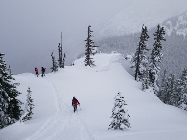
Great winter trip, enjoyed new untracked snow up high, skinned climbing ski tracks made ascent easier in many places and contributed to our ability to successfully summit the North Summit of Guye Peak and Cave Ridge.
- Sat, Feb 18, 2023
- Winter Scramble - Guye Peak & Cave Ridge
- Guye Peak, Snoqualmie Mountain & Cave Ridge (PCT)
- Scrambling
- Successful
-

- Road suitable for all vehicles
-
6 ft of snow on commonwealth creek bridge. The North summit of Guye peak is the typical stopping point in Winter. Beyond that it is a ragged rocky ridge. We had 6" to 12" of snow shoe penetration.
We triggered a small wind slab avalanche, smaller than a D1 that is relatively harmless to people, ours was relatively harmless to a cat. This is what was to be expected in the moderate avy report for the day. We were at about 5000ft on climbers left side of the large rocky band, climbers right is a better choice. These are excerpts from is my report on the NWAC site:
"Just started to traverse across a slope, triggered by the first person on snowshoes. Backtracked to a non wind loaded slope. Slid on a recent crust. We saw Pinwheels and tree snow bombs in the afternoon on our return to the Pass.
The Fracture line was 15 ft below ridge, on wind loaded 50 deg slope. 12" to 4"depth. 20ft wide. slid 30ft into trees. R1 D1 33'F 10kt wind from SE 11:30 am"
There where many other observations the same day: https://nwac.us/observations/#/obs This is part of the NWAC site I have not spent much time on. I'm left with the impression this event may not have even been big enough for most skiers to report.
As shared by other leaders I have been asking the group at the end of our trip what could we have done better today? My take away from this trip is everyone owned avy gear, but none of us had beacon's with us. How silly does that sound? In the future under required gear I will list beacons optional, bring them if you have them. It was a poor route choice.
We parked in the first lot on the right at the Snoqualmie Summit exit, arriving at 7:30 before the ski area crowds. In the afternoon we noticed cars angle parked in the wide shoulder on the East side of the road. This could be an option to avoid crossing the road. Not a great idea if snow plowing is happening.
Approximate times 7:45am to 5:15pm C2C Noon summit of Guye Peak 1pm on Cave Ridge Summit 2 short lunch breaks, in the trees out of the wind. About 9 mi with 3000 ft. of elevation. Our route Headed NE thru Commonwealth Basin, wrapping around the NW side of Guye Peak and climbing the NE ridge. We then headed over to the cave ridge summit, and blazed a descent off the SE side following pleasant terrain.
A very popular backcountry skiing venue we saw a dozen people on the way in and out close to the TH. What were a few skin tracks on the way in, became a slalom course on the way out in the Basin close to the TH. Otherwise we had the mountains to ourselves. It was great to get out in the new snow.

 Dave Schultz