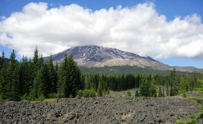
I’ve been slowly marking off the 100 hikes that Ira Spring and Harvey Manning published in their book 100 Hikes in Washington: South Cascades and Olympics. I recently completed my 40th hike from this well-used and much-loved trail book, enjoying a beautiful trip from Butte Camp to the Loowit Trail.
Few know that Bob and Ira Spring were born in Olympia in 1918. Ira Spring was a wildlife photographer and helped publish the first edition of the mountaineering bible, Freedom of the Hills, which launched the start of Mountaineers Books. Harvey Manning was born in Seattle in 1925, and at the age of 12 had a profound experience that would change his hiking history. He became an active conservationist and an outdoor enthusiast, joining The Mountaineers in 1948, sitting on the editorial committee in 1961, and also contributing to the publication of Freedom of the Hills. Harvey met Ira the same year he joined The Mountaineers, and their shared love of the outdoors and enthusiasm for wilderness experiences resulted in their collaboration on the 100 Hikes series. Our community continues to follow in their footsteps in more ways than one: local guidebook author Craig Romano has given us a modern version of their work in his beautiful book 100 Classic Hikes in Washington.
Ira and Harvey opened up the doors for the average hiker to get out and explore with their guidebooks, while also encouraging them to preserve the same wild places in their natural and undisturbed state. Read on to learn how you can also enjoy one of their classic northwest hikes.
Butte Camp to Loowit Trail
Gain: 1700 ft
High point: 4750 ft
Length: 7.6 miles roundtrip from Butte Camp. The extra mileage to the Loowit Trail #216 and beyond made our trip about 13 miles, as we hiked on the Loowit Trail towards Sheep Canyon.
Pass/Entry fee: Northwest Forest Pass
Supplies
- Sturdy boots and hiking poles, as walking on lava makes for unstable footing.
- The Ten Essentials – this includes additional water as there is very little until Butte Camp, and then access to water is dependent upon the season.
- Sun protection, including a hat, sunscreen, sunglasses, and a sun shirt, as there is little protection once you exit the forest.
Getting there: At Red Rock Pass on Forest Service Road 81, park at the trailhead marked for the Blue Lake, Blue Horse, and Toutle Trails.
The hike: The trail heads up a short climb from the parking lot, starting on Toutle Trail #238 and heading north where it quickly opens up onto a 1,900 year-old lava bed with majestic views of Mt. St. Helens. It quickly drops out of the lava bed onto a trail marked with lupine, beargrass, and other wildflowers.
The trail quickly changes from the lava field to a forest of lodge pole pine and fir. Keep right at the old ski trail, climbing gently to reach a trail junction at 1.1 miles. The Toutle Trail #238 heads west to the left. Head right to continue the steady but gentle climb to Butte Camp #238A. Here I was astounded to find candy stick, bromrape, pinesap, and pinedrop mushrooms in abundance. Take time to stop and see how many varieties you can identify.
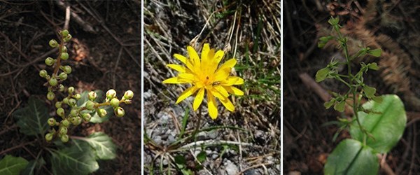 Left to right: rattlesnake plantain, false dandelion, heart leaved twayblade. Photos by Regina Robinson.
As you ascend, the trail is lush with huckleberries, wildflowers, and pine trees. At 2.4 miles we reached Butte Camp. The trail continued through what appeared to be a thin stream, with delicate monkey flowers, false hellebore, and lupine thickly lining the trail. I was pretty astounded to see my first and only three spotted mariposa lily in a meadow just before reaching Butte Camp.
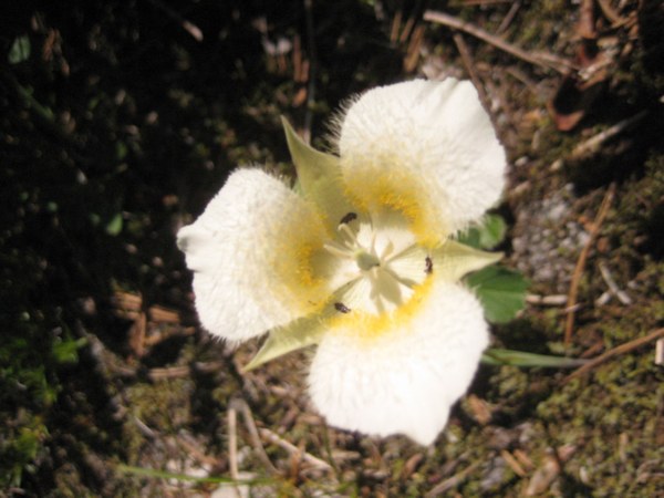 Three spotted mariposa lily. Photo by Regina Robinson
After our short break we continued uphill, hiking through a dry pine forest that took us up to an immense lava bed where we were in store for even more glorious views. What I had not expected from the desolate lava fields was that Mt. St. Helens was out in all her glory, decorated with thousands of red, blue, pink, white, and purple wildflowers. Mt. Hood stood proud and tall among the puffy white clouds. Around the 3.8-mile mark we eagerly reached the trail junction of Butte Camp where it joins the Loowit Trail. Here we sat under a warm summer sun, gratefully eating lunch while we admired the views. With only a couple of other folks who stopped for lunch too, we were treated to another perfect wilderness moment. Quiet reverence overtook us as we sat silently pondering the massive volcano and her wild temper and massive lava field.
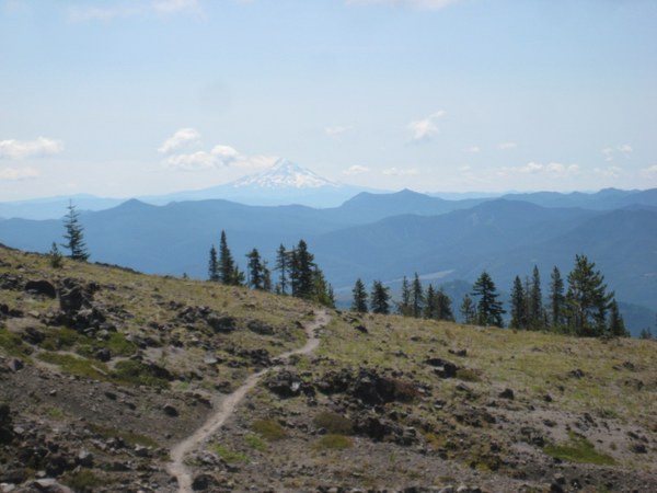 Lunch views of Mt. Hood looking southeast along the Loowit Trail. Photo by Regina Robinson
After lunch we chose to continue hiking on the Loowit Trail, taking it left at the junction heading towards the Toutle River and Sheep Canyon. We hiked for approximately a mile and a half without seeing another soul. We spoke about how underrated the hikes around Mt. St. Helens were - no people, no trash, and amazing views. We were happy that we “discovered” this awesome trail.
About a mile and half from the junction we crossed two huge washout gullies on the trail; both were steep, but nothing that couldn’t be managed without care and sure footing. Those gullies were definitely scary and fun; we were thankful that they were not gushing with water as they most likely would be impassable. Dan, one of the folks hiking with us, had his cell phone start to ding – who knew you could get reception on Mt. St. Helens! He discovered that, lo and behold, there was a geocache located on the Loowit Trail near us. Dan and I quickly discovered the location of the geocache, walking on rocks to avoid disturbing the delicate alpine vegetation.
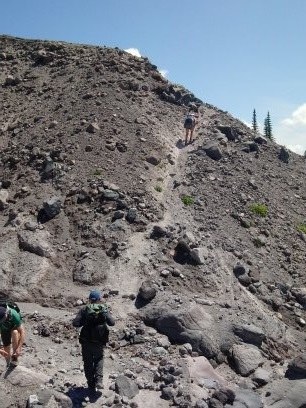 Photo by Regina Robinson
We opened the metal military container to find a t-shirt, glow stick, and a pad of paper to write down our names and the date we found the cache. Dan and I both agreed to leave the cache and not take any items, leaving just our names written on the pad of paper.
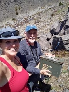 Photo of geocache, by Regina Robinson
Soon after finding the geocache, we noticed the weather starting to change. The general consensus was to get down and off the ridgeline as quickly as possible as the wind started picking up and it looked like rain. We made the mile and quarter trek back down to Butte Camp in record time. We stopped to admire the numerous wildflowers while scoping the place for our possible next backpacking trip. This area is amazing and deserves further exploration. From the camp we made it down to the cars in less than an hour and a half. Of course we stopped to admire the views, examined rocks, and identified the many wildflowers found along the way.
I cannot wait to get back up to this area; we will be adding the Blue Horse #237, Blue Lake, and Toutle #238 trails to our hiking lists of “must do hikes.”
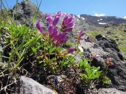 Penstemon among the lava rock on the Loowit Trail. Photo by Regina Robinson
Directions
From Woodland (exit 21 on I-5), follow State Route 503 east for 29 miles to Cougar. Continue east on SR 503 (which becomes Forest Road 90) for 7 miles, turning left onto FR 83. Follow this paved road 3 miles, bearing left onto FR 81. Continue for another 2.9 miles (road becomes gravel at 1.7 miles) to the trailhead at Redrock Pass (elev. 3100 ft). Park here at the trail head at Redrock Pass. The Butte Camp trail #238A is located at the Blue Lake, Blue Horse #237, and Toutle #238 Trailheads right at the top of Redrock pass.
Add a comment
Log in to add comments.Looks good. Consider the round the mountain trail. It's a classic and coming from me, that says a lot. Right up there with Milford Track in New Zealand and Mt. Kilimanjaro (but a lot easier). Great pics.
Hi David, I'm just now seeing your reply. Thank you for the information. I have the Loowit Trail on my list to do, I hear it is quite exciting! I would love to venture to both New Zealand and Kilimanjaro. Both would be wonderful! Thank you for the compliment on the photos. I love to stop and observe - I feel we don't often get that chance. ~Regina Robinson
 Regina Robinson