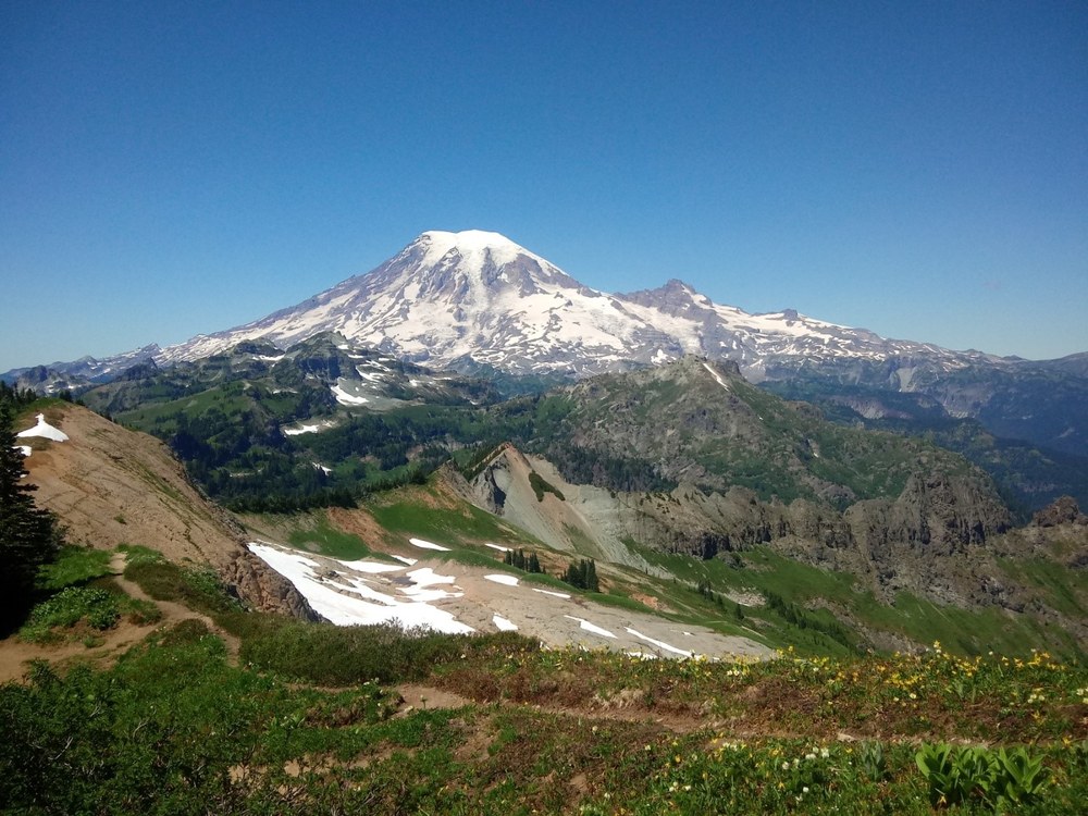
This summer I’ve been slowly marking off the 100 hikes that Ira Spring and Harvey Manning published in their second edition of 100 Hikes in Washington: South Cascades and Olympics. I completed my 41st as we hiked to the site of the former Tatoosh Ridge lookout on Tatoosh Peak, made famous in Martha Hardy’s book Tatoosh. This hike is neither for the faint of heart nor the causal hiker. It is steep, with some exposure and drop-offs that leave one wondering, “What am I doing this for?”
The Tatoosh Range, formed between 25 and 40 million years ago, is located along the southern boundary of Mt. Rainier National Park and runs roughly east-west, beginning with Tatoosh Peak to the southeast and ending with Eagle Peak to the west. The sharp features of this area were formed by ancient glaciers coming down off of Mt. Rainier.
Originally, the Tatoosh Trail was built to access grazing allotments for cattle in the 1920’s and 30’s. Historically the Tatoosh Range has long been a stomping ground for the Taidnapam (Upper Cowlitz) people of the Tieton River, members of the Chinook Nation. The Tieton River is a tributary of the Naches River. The Taidnapam people occupied the Cowlitz River from Mossyrock to its headwaters, including the Cispus River and Goat Rocks to the crest of the Cascades.
Following the berry ripening season, the Taidnapam would climb up the steep ridge starting in spring from their fishing camps along the Clear Fork Cowlitz River to hunt and harvest Camas and tiger lily bulbs, gather cedar and horsetail roots, and collect bear grass for basket weaving. In the fall they spent their time picking the abundant trailing blackberries, strawberries, salal, and huckleberries to store for their winter cache.
Archaeological evidence suggests that the trek up the Tatoosh was a long-standing tradition among the local Native Americans living along the Cowlitz River in the shadow of Mt. Rainier; a native hunting trail can just be made out along the ridge line on the Tatoosh Ridge trail. You too will want to make the trip to the top of the ridge - the views are breathtaking and the wildflowers abundant.
Gain: 3410 ft
High point: 6310 ft
Length: 10 miles, roundtrip
Pass/Entry fee: Interagency pass
Bring: 10 Essentials, hiking poles, boots, sun shade, and plenty of water as the small stream at 2 ½ miles may be dry during late summer.
Special conditions: Steep with exposure.
I’m not going to sugar coat this hike. For me it was one of the nastiest, most brutal hikes I’ve ever done; it could have been the heat talking, or the fact that I received very little sleep the night before. I guess some days hikes are easy and some days hikes are just hard. For me, this was my hike. It’s supposedly 359 feet shorter than Mt. Ellinor and less strenuous than Aasgard’s Pass, so with my experience on those hikes I anticipated that this would be easy. It wasn’t. It was one of the most difficult I’ve done, and was even downright scary when I tripped and almost fell down a steep rocky embankment. This trail is very rarely flat, so relish those few flat spots because they are few and very far between. That said, the views of Mt. Rainier, Mt. Adams, Mt. St. Helens, Mt. Hood, and the wildflowers will blow you away. This hike is definitely in the category of “no pain, no gain,” and it is so very worth it! The “ooh’s” and “ahh’s” coming from the group never stopped, even when some of us were wheezing and gasping uphill.
The day we hiked this trail it was 90 degrees in Packwood at 9am. We certainly didn’t expect such heat, but we decided as a group to go ahead anyway as we heard “the views are out of this world.”
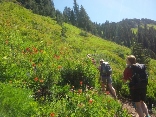 Hikers stop to admire the flowers. Photo by Regina Robinson.
Tatoosh Ridge Trail #161A starts off quickly ascending a Douglas fir forest that is dim and dry, similar to the forest you hike through right before ascending to Tull Canyon on the Tubal Cain trail. It is dark, dry, and dim; as the trail switchbacks upwards, it slowly gives way to a lusher, greener forest filled with oregon grape, sidebells, pipsissewa, spotted coral root, various ferns, Alaskan cedars, mountain ash, and hemlocks, occasionally opening up affording views of the surrounding hillsides. The viewpoints are excellent places to catch your breath, eat a snack, drink some water, and take photos.
About 15 switchbacks later (there were more but I stopped counting), or approximately 2 miles in, the trail opens up to a vast sloped wildflower-filled meadow. It is a floral explosion of color. Sitka valerian, bistort, Colombia tiger lilies, red sitka columbine, Indian paintbrush in reds, oranges and magenta, purple asters, pink subalpine spirea and white bear grass are just a few of the wildflowers that you will see along the trail.
Just shy of 2.5 miles, a creek crossing makes for a lovely, welcome break area with broad stone steps to sit upon. This is the only water source on the trail (unless you head up to Tatoosh Lakes on trail #161B). Blue butterflies swarmed the damp ground around the water, flitting between the large groupings of pink monkey flower, buttercups, and bluebells, making this sweet spot hard to leave.
Just uphill from the stream you reach a junction in the trail; left leads up to Tatoosh Lakes and the right junction will continue on a long uphill to one of the first ridges. Forgoing the lakes, we pushed on, traversing the first steeply sloped meadow with wide open views of Mt. Adams, Mt. St. Helens, and Mt. Hood.
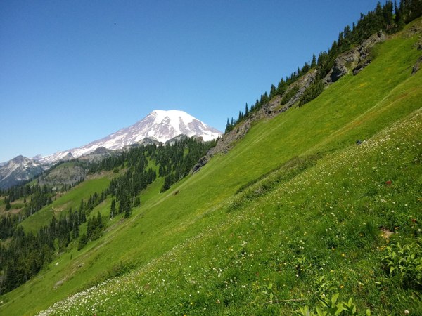 Views of Mt. Rainier. Photo by Regina Robinson.
The steep ascent continues before popping out onto a shoulder with majestic views of the Cowlitz River Valley below and the volcanic mountains we are so blessed to have in our back yards. With such commanding views, we took a much needed pack-off break. This is the last portion of shaded trees until the next ridge so take one more moment, enjoy the view, and head off because more adventure awaits you.
From here we dropped down about 300 feet, continuing towards the next ridge where at 3.6 miles we crossed a major slide area. The area is rocky and unstable, making solid foot placement difficult. Take your time as a friend fell here at this spot three years ago, suffering several broken ribs and lacerations across his head, hands, and legs.
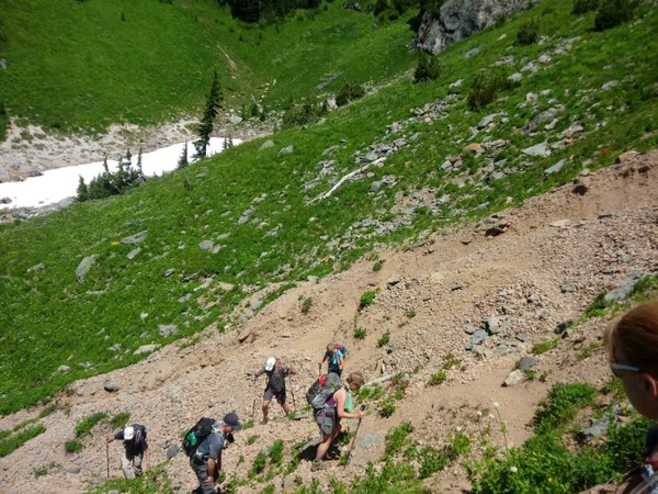 Hikers crossing the slide area. Photo by Regina Robinson.
After safely crossing the gully slide area, we began the second traverse up and across another steep flower-filled meadow. The trail becomes narrower and rockier with some steep exposure and drop offs - this is definitely an area to mind your foot placement. The trail also has very dense vegetation, making holes and soft spots on the trail hard to spot. It would be easy to misplace a boot step; you really don’t want to fall over here! The sloped meadows are graced with wallflower, Cusick’s speedwell, penstemon, and bistort. Looking back over our shoulder the views of Mt. Rainer were quite captivating, causing many of us to stop and ponder this grand area.
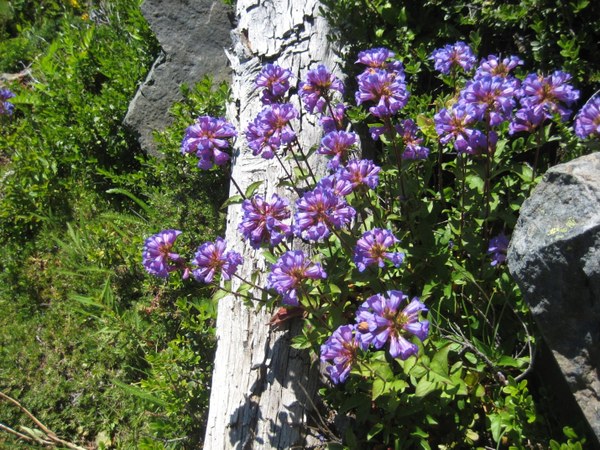 Penstemon. Photo by Regina Robinson.
The third traverse hikes along another flower-filled meadow, switchbacking straight up where it brings you onto a false summit at 4.5 miles. Here the trail veers sharply to the left; the views of Goat Rocks Wilderness, Packwood Lake, the Cowlitz Valley, Mt. Adams and Mt. St. Helens dominate the skyline. From here it is only a 0.7-mile climb up the hill on a deeply rutted narrow trail, which leaves one trying not to trip over one’s boots while gawking at the 360 views, with Mt. Rainier peeking shyly over the ridge’s shoulder.
At 6400 feet the former lookout site offers a spot to stop and take in grand views of Mt. Rainier. Although the lookout no longer remains, remnants still exist, a square chunk of concrete providing a grand seat to take in the views. The apex of Tatoosh Ridge, Tatoosh Peak, is an amazing lunch spot with commanding views. We were in awe of Mt. Rainier standing proudly behind the Tatoosh Range - and we were grateful that the day was clear, with just a hint of wildfire smoke filling the eastern sky. It really made us all thankful that we live in such a beautiful state.
For all you geocachers out there, there’s another geocache to be found. I’m considered a “muggle” in geocache language (one who does not geocache), but I continue to locate them on hikes. My first accidental geocache was found on Church Creek, my second on the Loowit trail, and my third was right here at the Tatoosh Ridge summit.
Descending the trail, the steepness does not let up; this is where your hiking poles really come in handy. I needed my knee brace for the downhill – it’s unrelenting.
Be kind to yourself on this hike, it is steep and rewarding. Be sure to take many breaks, drink lots of water, eat yummy snacks, and take lots of photos. Last but not least, please drop me a line and tell me about your hike.
After a hard day hiking my friends and I like to enjoy a cold beverage and something hot and yummy to eat before the long drive home, so we make Cliff Droppers our go-to stop in Packwood. If you haven’t already checked them out, you might want to stop by the next time you’re in town.
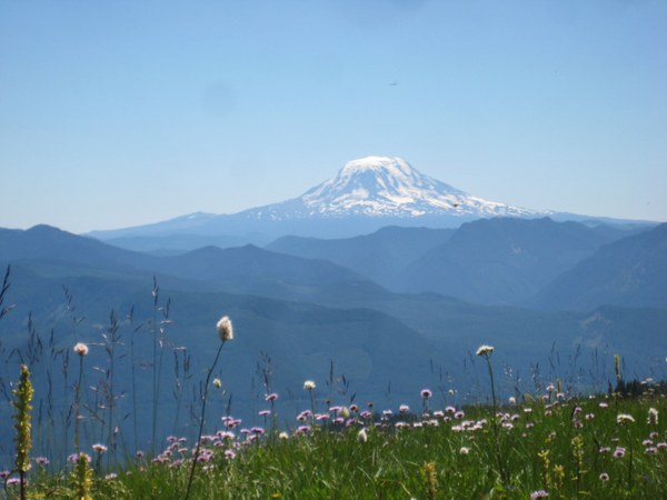 Wildflowers and Mt. Adams from the false summit. Photo by Regina Robinson.
Directions
From Olympia: I5 South to Hwy 12 East, to Packwood. Turn left onto Skate Creek Road. Drive 4 miles then turn right (North) onto Forest Service Road 5270, continue 7 miles to the signed trailhead (at 2900 feet).
Add a comment
Log in to add comments.Sounds like a great (challenging) hike. For a bite in Packwood, I can recommend the Blue Spruce. I've been there a couple of times and had a fine time each one. It looks like a tavern on the outside, but when you go through the doors, it looks like a tavern on the inside, too!
Mike, that sounds great- I've never hiked the Blue Spruce, I will check it out and add it to my list of places to "must eat."
Mike, that sounds great- I've never hiked the Blue Spruce, I will check it out and add it to my list of places to "must eat."
 Regina Robinson
