Mount Rainier National Park has over 100 climbable peaks — not counting Mount Rainier itself — either within or immediately adjacent to the Park boundary. Most are scrambles, a few are climbs, and 15 peaks are reachable as hikes.
by Mickey Eisenberg, Gene Yore and Pete Sabin
Lookouts of Mount Rainier
This installment of Our Secret Rainier guides you to the four Lookouts in the national park. Over time, there have been eight lookouts within the park, but only four remain standing today.

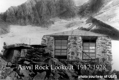
Of the four in extinction, the first was Anvil Rock (elevation 9,500 feet). Though built in the national park, it was operated by the forest service. Originally constructed of stone, with the fire finder outside, it was replaced by a wooden structure in 1928. In 1930, the park service took over operation — and in 1948, the entire structure was removed. The Collonades Lookout was built above 7,100 feet on the west side of the park in 1930 and replaced by the Sunset Park lookout in 1948, at a lower elevation. The last was a lookout at Crystal Peak, removed in the 1960's, and is still a popular hiking destination.
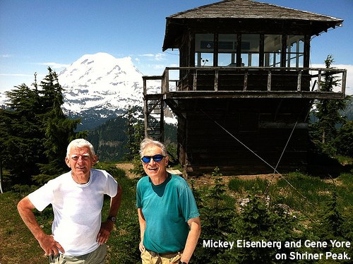
The four lookouts that remain are Shriner, Fremont, Tolmie, and Gobblers Knob. They are historic sites that are no longer staffed but are used as back country ranger stations and house radio repeaters. Though these lookouts are hardly “secrets,” one of them, Gobblers Knob, is relatively unknown and infrequently visited. All four are accessible as hikes and listed in Guide to 100 Peaks at Mount Rainier National Park.
Shriner Lookout

- Skill level: Moderate hike (if snow free)
- Distance: 7 miles round trip
- Elevation gain: 3,400 feet
- Total time: 5 hours
- Best season: Summer into fall
- Maps: USGS Chinook Pass & Green Trails Mt. Rainier East
- Equipment: Hiking gear
Route Description: The trailhead is marked with a large sign on the east side of the road. Hike 3 miles to the lookout. The route starts in old-growth forest and breaks out into the open at 4,200 feet.
Directions to Trailhead: Drive SR 410 south to Cayuse Pass and continue south on SR 123. Approximately 7.5 miles past Cayuse Pass, park at the Shriner trailhead on the west side of the highway. Park entrance fee is not required.
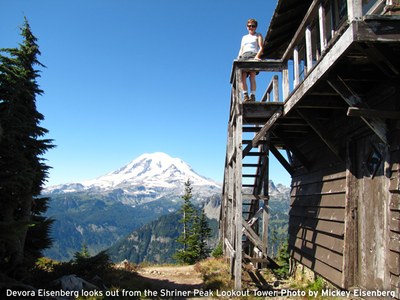
Note: The lookout is located on the summit of Shriner. Shriner is a classic hike, with old-growth forest opening up to alpine vistas and grand views of Mount Rainier. In late spring the upper slopes may still be snow covered, making route finding a bit of a challenge. Large noble firs are found just off the trail on the upper slopes.
Fremont Lookout

- Skill level: Easy hike
- Distance: 5 miles round trip
- Elevation gain: 1,200 feet
- Total time: 4 hours
- Best season: Summer into fall
- Map: Green Trails Mt. Rainier East
Route Description: The trailhead is located to the right of the restrooms. Begin uphill on the asphalt trail leading to Sourdough Ridge, and follow trail signs to Fremont Lookout.
Directions to Trailhead: Drive SR 410 4.5 miles south of the Crystal Mountain ski area turnoff and turn right on Sunrise Park Road. Drive 15 miles to the road’s end at the Sunrise Visitor Center parking area.
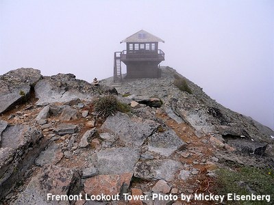
Note: The lookout is located on the northern most point of Mount Fremont. The actual summit of Mount Fremont is located about .25 miles south of the lookout. It is an easy scramble from the trail to the summit. This trail is popular on pleasant summer weekends.
Want to learn more?
Guide to 100 Peaks at Mount Rainier National Park is available on iTunes and as an electronic book (for tablets and phones). It is also available as an iBook through the Apple bookstore. All royalties are donated to The Mountaineers.
This article originally appeared in our May/June 2014 issue of Mountaineer magazine. To view the printed article and read more stories from our bi-monthly publication, click here.
 Mickey Eisenberg