Many Pacific Northwesterners rely on cars to get to the mountains, forests, islands, and waters to adventure and experience nature. Yet, you don’t need a car to access these beautiful places. As an experienced and carbon-conscious adventure cyclist, I’ve rolled directly from home on many previous adventures, and prefer my trips rely on just two wheels.
My first big cycling tour was a coast-to-coast tour across Canada during a hot summer when much of British Columbia was burning. And during the Covid-19 pandemic, I pedaled a two-week, 360 mile loop around the Puget Sound to see the Salish Sea from the saddle after a friend asked, “Sure, you’ve biked on the San Juan Islands, but have you ridden to them?” I frequently ferry to Washington State Parks for bike overnights, and even take trains north to Skagit Valley in spring to tiptoe through the tulips.
I had just returned from a 1000+ mile solo bike tour along the Pacific Coast Highway when I was invited on a unique opportunity to try bikepacking for the first time. The plan was to bikepack Vancouver Island’s 120-mile Cowichan Valley 8 route straight from our front door in Seattle, with the help of the Victoria Clipper ferry.
While I’ve done extensive bike touring on paved roads, bikepacking was a shift. Bikepacking requires traveling off-road on gravel trails that necessitate tires optimized for rougher terrain, including steep grades, gravel of all sizes, and “peanut butter” mud. You usually pack much lighter, for optimum balance, and plan to get a lot dirtier. I was eager to combine my mountaineering, backpacking, and bike touring experiences for this nearby bikepacking trip.
To shift from a long cycle tour to this four-day gravel bikepacking adventure, I made a few minor adjustments to my steel frame touring bike, to my gear, and to my mindset. I invite you to come along for the ride.
Prepping for a multi-day bikepack
Just like the proper footwear needed for through-hiking the Pacific Crest Trail or boot packing a glacier, the right tires make a bikepacking trip much more enjoyable. Because the Cowichan Valley 8 route is mostly gravel, I swapped my touring tires for a slightly wider and knobbier set, better suited for gravel because they allow more surface area to be in contact with the variety of gravel size. The wider tires meant I had to remove my rain-blocking fenders to allow for more clearance, but fortunately the weather forecast for late August was blue-skied. To make the ride a little smoother, I deflated the tires to around 35-40 psi. This takes pressure off your joints by essentially adding some suspension to the ride which absorbs the vibrations of the gravel road.
Planning provisions along the path is another important part of packing light. Unlike a long backpacking trip where every calorie might be accounted for months in advance (and even delivered to resupply stations), the Cowichan Valley 8 bikepacking route had regular opportunities for re-supplying.
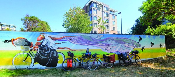
Cycles resting against a cephalopod mural along the Galloping Goose Regional Trail.
While I have a handmade kitchen kit for longer tours, including a “food repair spice kit” and guaranteed stash of backup hot chocolate, this route required fewer supplies. One bowl, one bamboo spork, and a couple of lightweight backpacker dinners for the first night were all I needed. Even though water access is usually readily available on more urban tours, I packed a lightweight water filter just in case, which ended up being useful on a few occasions.
My system was sleek and balanced. Because my bike doesn’t have front fork mounts, I secured my panniers to the front rack with removable zip ties and used Voile straps (which I used for backcountry ski gear) to secure my tent and poles on the back rack. For my non-biking camp shoes, I packed the lightest flip-flops I owned. I was ready to ride.
Day one: Salish Sea to regional trails
It’s easy to pay attention to the scenery from a bike’s saddle. As I rolled down the hills on the way to the ferry terminal, I soaked up the stunning sunrise view of the Olympic Mountains. The waterfront trail along Elliot Bay was still under construction, and I dreamed of peering through the pilings to get a peek at a wild giant Pacific octopus. Up ahead, people at Pier 69 were already lined up for the Victoria Clipper. A few of my trip companions were among them. Unlike Washington State ferries that don’t require bike reservations, the Victoria Clipper requires all passengers to pre-book their passage as there is limited space for bikes.
While floating across the Salish Sea, we kept an eye out for our favorite marine mammals: orca whales, Dall’s porpoises, and harbor seals. Gulls glided by as we gawked from the gunwales, watching the water weave various shades of blues under an equally magnificent sky. After crossing the international boundary between the United States and Canada in the Strait of Juan de Fuca, we pulled into the city of Victoria, a mere 2.75 hours later.
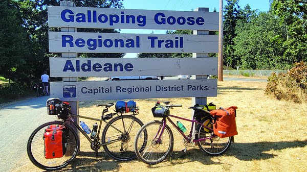
Bikes along the Galloping Goose Trailhead.
The Cowichan Valley 8’s 120-mile route starts and ends in front of Victoria’s Parliament building and winds through the city across Johnson Street Bridge toward the first of many well-marked regional rail trails. Eating lunch at the Fol Epi cafe meant we could carry a lighter load as we began the trail. We started at the Galloping Goose trailhead, which travels backroads to Saanich before paralleling, and then crossing, the Trans-Canada Highway into Lanford. Plenty of vegetation — ferns, shrubs, and rock outcrops — shaded much of the concrete. Bigleaf maple leaves rustled as we rode by. The trail smelled strongly of sweet dirt and blackberries so plump and within reach that if we dared slow our wheels we’d risk thorn pricks.
The route continued through the Westhill suburbs, with a steep climb to Irwin Park, and a long descent down Humpback Road where a corner store at the junction of Sooke Lake Road offered cold drinks and a variety of my favorite Old Dutch potato chips, a surprise pre-dinner appetizer. We rolled across the street to the Goldstream Provincial Park for our first night at camp and cooked one of the backpacker meals I packed for the first night. Unlike Washington State Parks who have no-turn-away policies for hikers and bikers, reservations for provincial parks are required and can be made up to four months in advance at camping.bcparks.ca.
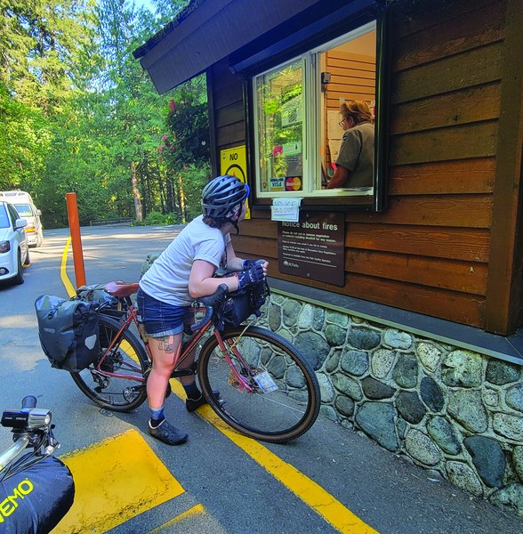
Bikepackers checking in at Gold Stream Provincial Park.
Day two: A river runs through it
Goldstream Provincial Park is just outside the protected watershed of the Greater Victoria Water Supply Area. The bike route wraps around the Humpback Reservoir and into the Sooke Hills Wilderness Trail, a 13-kilometer trail through forests, over hilltops, and across rivers in the 4,000-hectare wilderness of the Sooke Hills Wilderness Regional Park. The area is home to bears, cougars, and wolves, but we kept these large carnivores away with brightly colored bear bells that bounced under our behinds. The Sooke Hills Wilderness Trail is part of the Great Trail, a multi-use trail system that spans across Canada, and was by far the most challenging of the trip. There is a suspension bridge crossing the Goldstream River, steep grades up to 16%, narrow sections, loose gravel, and limited to no cell phone coverage.
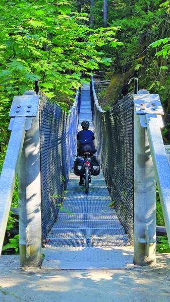 A bikepacker on the Sooke Hills Wilderness Trail suspension bridge.
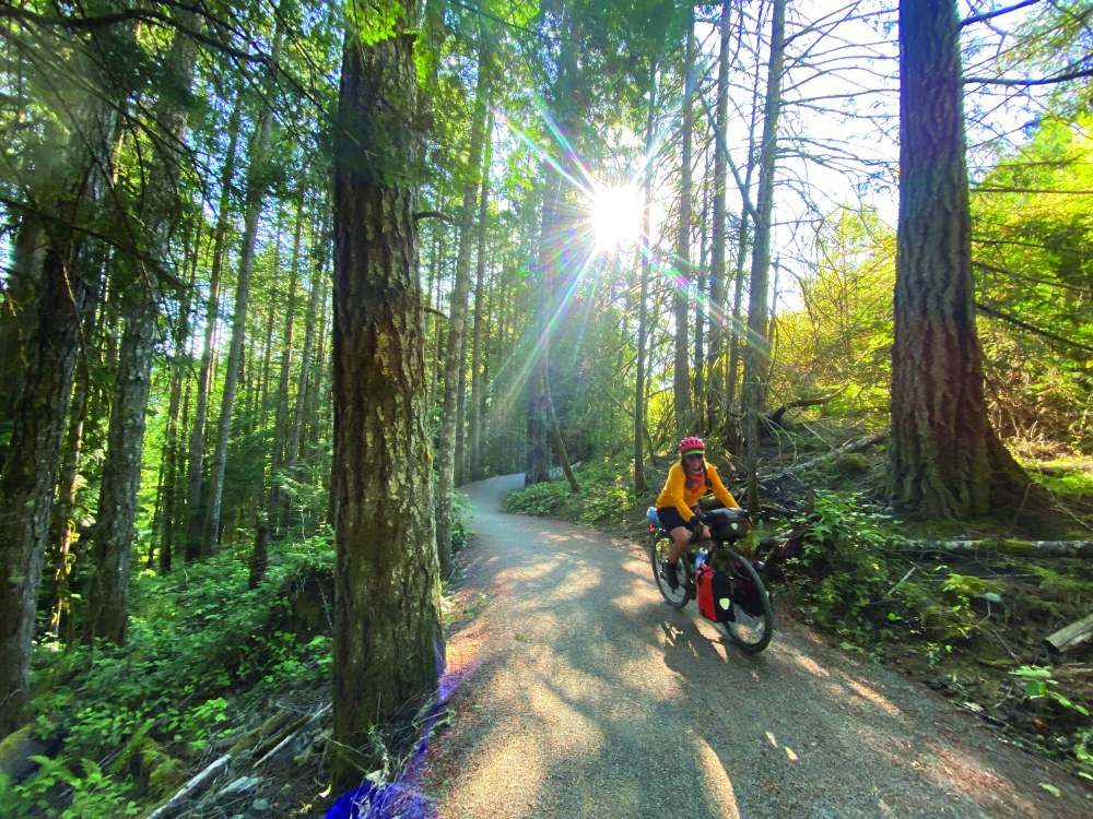
It was slow going those first three hours, but it was also the most beautiful. Morning light banked around gravel curves, and I could hear the sound of my breath through the stillness. Being immersed in the serenity of nature reminded me that bikepacking is just backpacking on wheels. Sometimes it’s also walking those wheels. When the grade got too hard to pedal, I would use all my strength to push the bike uphill from behind. Where northwest rains washed rivulets down the steep parts pocketing the path, just to be safe, I would dismount and walk the bike along the edge of the wash.
I was pausing to catch my breath and read a large trail map when a friendly local stopped to say hi. He reminded us of the scarcity of water this particular August, despite our proximity to a watershed, and encouraged us to ask residents for water refills when the trail crossed into the community. Later on, along the Koksilah River below the Kinsol Trestle, I used my lightweight Sawyer Squeeze to filter more drinking water. As the stream babbled, I listened to the stories it had to tell of the sword ferns, the bigleaf maple, the moss, the kingfisher, and the riparian macroinvertebrates nearby. As my cleats tapped on river stones, I offered thanks.
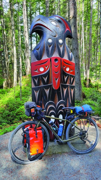
Near the south end of Shawnigan Lake, just before the bridge over Shawnigan Creek, there was a wonderful welcome. The Yos totem pole featured a central thunderbird with a beak pointed in the direction we were heading. With the difficult climbing behind us and the smooth gravel of the rail trail ahead, the bird seemed to give me wings.
The Yos Totem pole, carved by Stz'uminus artist John Marston, Nuu-chah-nulth artist Moy Sutherland Jr., and several youth from the Malahat Nation.
The next 25 miles to Lake Cowichan were quick. The slight downhill made the gravel sing. Grit gathered on my shins and everywhere. I’d never been dirtier. I turned my face to the breaks of light weaving through drapes of moss in deep forests and smiled. I paused to soak in the expansive views from the Kinsol Trestle, Holt Creek Trestle, and 66-mile Trestle. My favorite view was the 70.2-mile trestle high above the gorgeous greens of the Cowichan River. The silence of the wilderness was incredible.
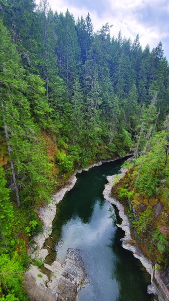 Cowichan River Gorge from the 70.2-mile trestle bridge.
We arrived at Lake Cowichan in the late afternoon sun and feasted on an early dinner and milk shakes at the delicious J and V’s Diner before heading to our campsite. I paused for a photo at the western terminus of the Trans Canada Trail sign which rests at the top of Cowichan Valley Trail’s figure eight and parallels both the Cowichan Lake Road and the nearby Cowichan Valley Highway. Ten miles later, via a slightly uphill grade on great gravel, we dropped to the Cowichan River Valley Provincial Park to make camp for the night.
Water was not potable here, so we had to filter the water we obtained from the campsite’s huge iron pump. But the river itself was a sheer delight. My friends and I held back vegetation for one another as we made footprints in the sandand hung small towels and t-shirts on the branches before tiptoeing into the river. I let the flow of the water massage my muscles and rubbed my legs to loosen the grit and grime. The dirt, debris, and sediment that had collected on me returned to the riparian ecosystem.
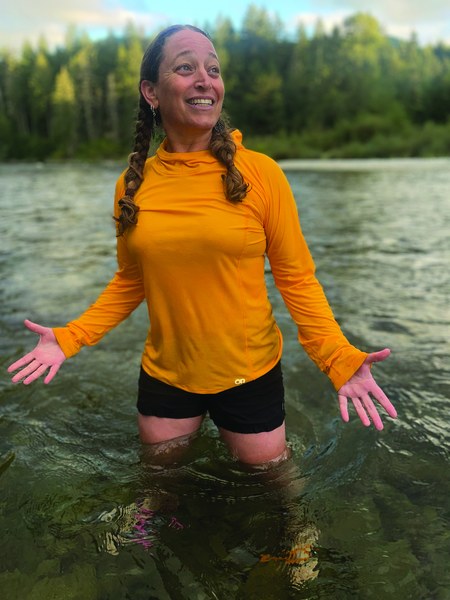 Jessica enjoying the water massage in the Cowichan River. Photo by Greg Downing.
Day three: Toads and totems
We learned from a Cowichan River Valley Provincial Park ranger that riding along Riverbottom Road would bypass the steep grade that exits the park. His route took us on a more meandering path that rolled up and down less-intense hills for a few miles. At the junction of Barnjum Road, a curious caution sign jumped out at me: “Watch for Toads!” It was a neat surprise to learn that western toad migration happens here annually for three weeks each year as small toads cross the road to the Wake Lake Nature Reserve.
A mere ten miles after we left camp, we rolled into the town of Duncan, “The City of Totems.” The town has 44 totem poles honoring the peoples and traditional lands of the Quw’utsun’ (Cowichan) people. Yellow footprints on the pavement connecting each totem pole to one another demanded we detour for a closer look. The lollygagging led us to the Saturday farmer’s market, the longest-running, year-round farmers market in British Columbia. Syrian falafel, a pint of summer strawberries, and live music made for a feast that propelled the afternoon ride to Mill Bay. The long, summer days gave plenty of time to provision and grab an ice cream cone before continuing along Mill Bay Road toward Bamberton Provincial Park Campground.
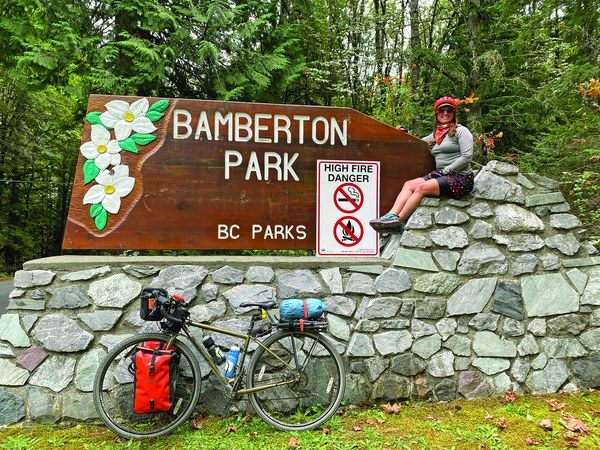 Jessica at the Bamberton Park entrance. Photo by Therese Casper.
Day four: Ferries and finish
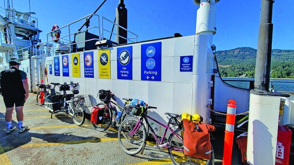
The final day of our trip routed us across the Saanich Inlet on the ferry from Mill Bay to Brentwood. Our bikes had plenty of space to park along the ferry wall, and we had time to stretch our legs and reflect on the intersection of forest, rivers, and seas that make our Pacific Northwest region a marvelous place to adventure, even without a car.
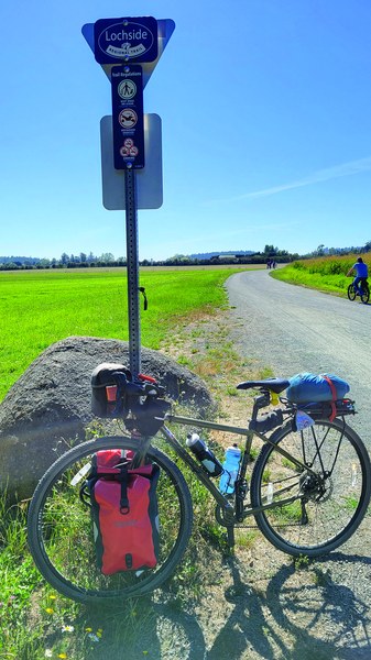 A portion of the Lochside Regional Trail, which winds from the Saanich peninsula back to Victoria.
Crossing the Saanich Peninsula through Malahat and Tsartlip First Nations lands to Lochside Drive is rural and rolling. The Lochside Regional Trail burst with summer cyclists on that sunny Sunday. It was a lovely ride along the Blenkinsop Valley Greenway’s agricultural fields. The Galloping Goose Regional Trail took us right back to Victoria, where we celebrated our loop’s completion with a meal and a photoshoot in front of the parliament buildings before biking the short few blocks to the ferry.
Ample bike parking on the Mill Bay to Brentwood ferry.
Hours later, by that lovely lingering late-day light, I let the sun set on my successful bikepacking adventure. How lucky we are to live where you don’t need a car to access nearby nature. Two feet, two wheels, and a few ferries can foster deep connections to this place along the Salish Sea, where rivers run through the fragrant forests, toads hop towards totem-filled towns, and blackberries beckon. I was joyfully covered in grit, my tires had rumbled the gravel with grace, and I was ear to ear with one big grin. After disembarking the ferry, I rode right on home.
This article originally appeared in our summer 2023 issue of Mountaineer magazine. To view the original article in magazine form and read more stories from our publication, visit our magazine archive.
 Jessica Levine
