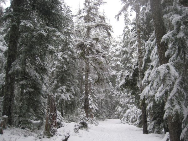
The night before our snowshoe trip to Mount Rainier, I was a tad nervous reading the weather forecasts. I had been diligently reading them for a week prior, because a winter storm advisory was in effect. In addition, the avalanche danger had increased with all the new snow and slight warming trend. The next day, the expected weather forecast stated we were in for 90% precipitation, rain at lower elevations and snow higher. I was uneasy, and kept hoping that the road to Paradise would be closed. My backup plan for our adventure was to stay low and safe with a short snowshoe around Longmire.
Due to the high avalanche risks, Avalanch.org posted an avalanche danger of 4 (high), when it had previously been a 3 (considerable risk). Thankfully, when we arrived at the Nisqually entrance, the Longmire to Paradise Road was closed due to excessive snow and the anticipated incoming snow, with no estimate for reopening. The crews, prior to reopening, needed to assess snow/road conditions and clear the road for safe travel. That was not going to happen that day.
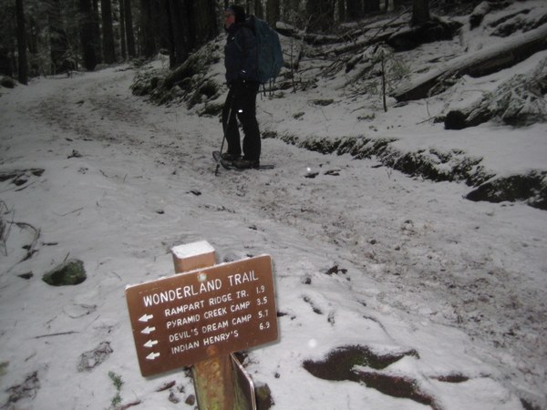 First junction at just under a quarter of a mile.
Instead of leaving the park like so many others were doing, we opted to stay low and snowshoe from Longmire. There are several options available: head up to Rampart Ridge, or Eagle Peak, both options that involved traversing avalanche terrain, or take the short hike on the Trail of Shadows Trail through a forest meadow, where one can view a mineral spring and a replica of an early homesteader’s cabin. The other option was to take a portion of the Wonderland Trail; either traveling up to Indian Henry’s or Van Trump Park, or venturing up towards Carter and Narada Falls. Since each of my adventure partners had already hiked or snowshoed the first two options recently, and due to the high avalanche danger, the Rampart Ridge and Eagle Peak options were out. We chose to stay low and explore on the Wonderland Trail, in the direction of Carter and Narada Falls.
For all my years of exploring on Mount Rainier, I had not hiked to either of the falls, although I had often used the parking lot at Narada Falls as a starting point to snowshoe up to Reflection Lake.
The Wonderland Tail begins directly across from the parking area, museum, and bathrooms at Longmire. Listed as one of the more strenuous hikes within the National Park, the trail circumnavigates Mount Rainier at 93 miles long and 23,000 ft. of elevation gain. This portion of the Wonderland Trail was once part of an old road, established in 1906. The Mountain Road, as it was so aptly named was first used by wagons, pack horses, mules and foot traffic.
The park had just about 1,700 visitors a year by 1906. The automobile changed everything, and visitation rose to around 35,000 a year visitors by 1913. By 1907, the first government-constructed road lead to Longmire Springs.
In order to keep up with the high demand to visit the park, they increased accessibility in 1910 by building the road to Paradise Park, thus creating the day use visitor. Up until this time, travel by train, wagon, and or pack animal extended the time one spent on the mountain. The day visitor explored the front country, hence the many roadside trails, while the overland explorer wanted a more primitive backcountry experience. For just $7.00 round trip, a visitor could take a ride to Paradise in an eleven passenger touring car.
I honestly cannot imagine trying to take a car on that original road, where mules were often needed to pull vehicles over steep grades that were considerably muddy, rough, and rocky. I think I would have chosen to ride one of the mules, pack animals or walk, instead. Significant road changes were made during the 1920’s and today, roads within Mount Rainier National Park are continuously improved.
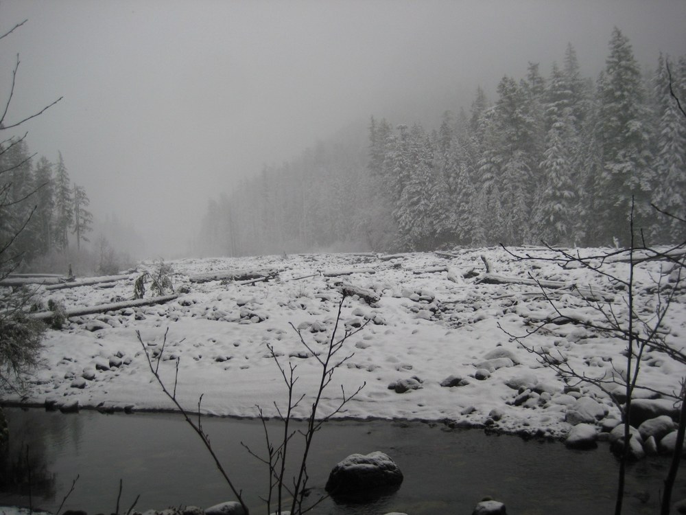
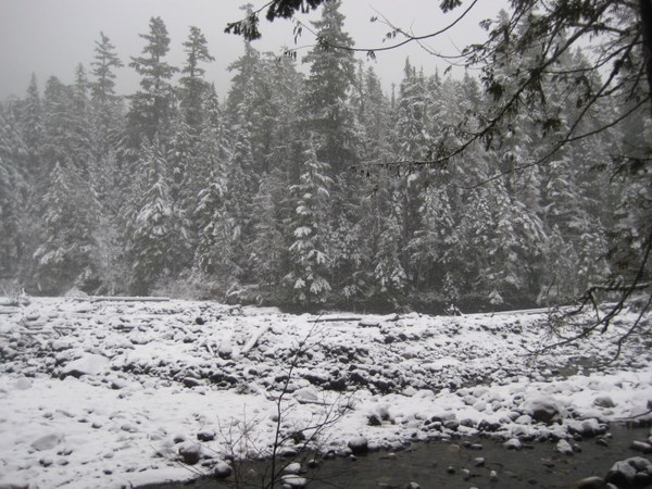 Nisqually River as viewed from the Wonderland Trail
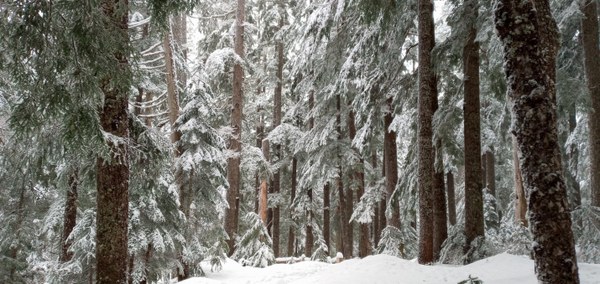
We started off in snowshoes, but quickly realized the snow was just a bare dusting through the dense cedars and firs lining the trail. Just after the first spur trail that lead up to Rampart Ridge and Indian Henry’s, some of us took off our snowshoes and put on our microspikes, adjusted our clothing layers, and ate a small snack.
While we adjusted clothing and gear, two small groups of hearty hikers passed us, rapidly moving up the trail. We expected far more people to be on the trail because the road to Paradise was closed, yet we were quite delighted in the small numbers of people, as that meant that the masses chose to either hike Rampart Ridge or stay in the meadow area near Longmire. We relished the solitude amid the trees.
At 1.6 miles we reached the next junction, which led off to the left towards Cougar Rock Campground. Our next junction was just ahead at 1.8 miles, where the trail and road meet at the pullout viewpoint of the Nisqually River and the junction for Carter Falls Trailhead.
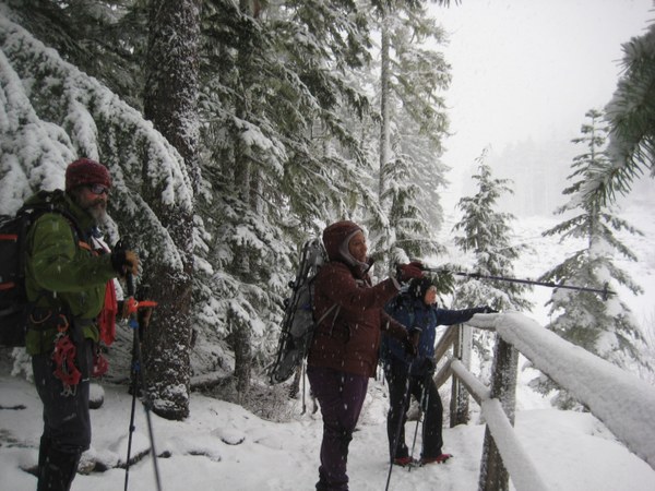
Here, we stopped to assess the snow conditions and if it would be wise to cross the bridge over the Nisqually River. We decided to continue to the river and once we got down to the bridge, we would again stop and assess conditions. After evaluating the bridge up close, we decided to cross slowly, with a spotter watching each person as they crossed.
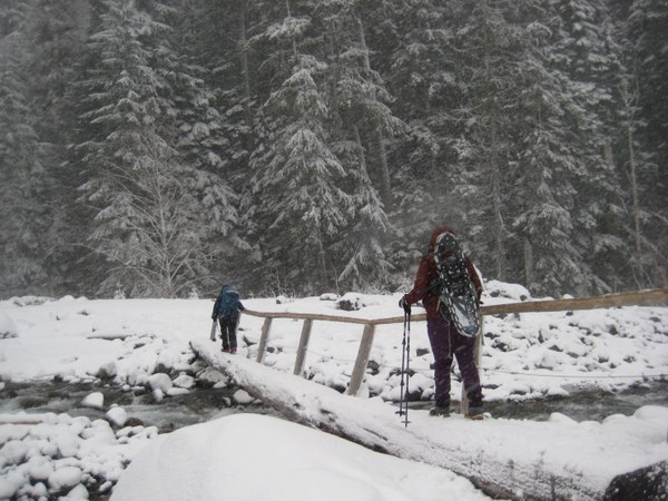
Mindfully crossing the Nisqually River on a footbridge, that was slightly tilted and slippery with ice, I was relieved when I did not accidentally go swimming in the very cold, fast moving waters. I suggest using caution on the bridge, especially during winter conditions. After I got home, I looked up the Carter Falls trail on the parks’ website. Apparently, from the bridge, there is a magnificent view of Mount Rainier, which gives me another reason to check this hike out during the springtime. Not that I didn’t enjoy the snow; I just want to see the mountain in all her glory.
Once across the bridge, we decided it was time to take off our microspikes and put on our snowshoes as quickly as we could. The wind was blowing hard, the wind whipping through the valley with falling snow becoming icier.
From here, the trail heads left and starts an uphill climb, where thankful the wind was deflected by trees. We came out onto to a wide flat saddle that would be an ideal picnic spot, especially in the summer time, shaded by those beautiful grand old Douglas Firs, cedars and hemlocks. We paused to eat a snack and chat while savoring the beauty of the tall trees shading the trail. After our quick snack we continued moving uphill, saving lunch to eat at the falls.
The trail from the bench leads up into the Paradise River Valley following the river, offering peek-a-boo views of the river and valley below. There are several spots to step off-trail and take in the views, being mindful of how the river undercuts the trail in some areas. I suggest not getting too close to the edge especially with the snow creating false balconies. As the trail climbs, it becomes narrower, steeper, with some exposed areas and steep drop-offs that were slick with ice.
With about a mile to go to the falls, the wintery stillness and silence was deeply meditative. In the trees, you could hear no wind and no birds, only the slight sounds of our snowshoes, trudging uphill. It gave me time to reflect on the beauty of this hike.
I have not spent a lot of time adventuring on trails located right off the road at Mount Rainier. Usually the hikes closest to the road are the easier hikes, often overloaded with outdoor enthusiasts. I prefer solitary adventures with few people and grand views, however, I could clearly see that I would have to come back to visit Carter Falls during the spring and summer time, braving the crowds, just so I could see what lies below the thick blanket of frosty winter snow.
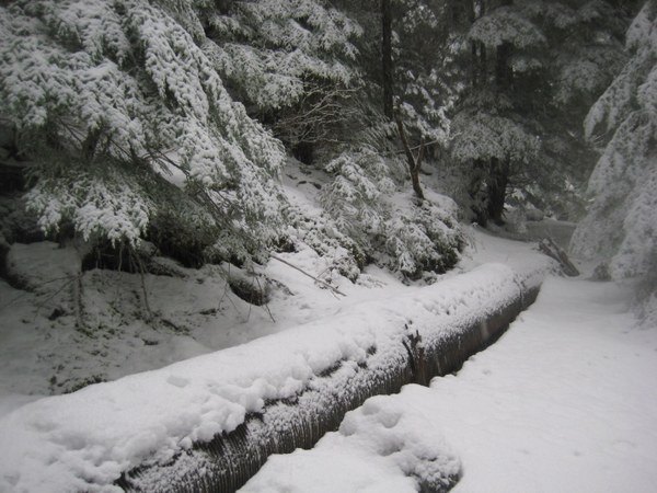
On a portion of the trail, what appeared to be a metal pipe, or penstock ran alongside the trail. The penstock is a water sluice, wrapped in steel bands. It once carried water to Longmire from a dam on the Paradise River, and a hydroelectric power plant that generated electricity at Longmire.
Built in the fall of 1920 at the high cost of $75,000, the dam, penstocks, and power plant provided electricity to both Longmire and Paradise, but by the 1970’s they were obsolete and abandoned, later being demolished sometime in the 1980’s. I wish I had known about this when I was much younger; it would have been interesting to see such infrastructure along the trails, the last remnants of the early development of Mount Rainier.
After passing the penstock, we were not too far from the falls. We continued up hill, with the sounds of crashing water getting louder and louder. On this section of the trail, there are several larger trees that are worth stopping to admire. We paused to contemplate their beauty, listening to the wind whisper gently through the treetops. Several of us reached out and hugged those massive trees, giving them silent thanks for just being. If you have not ever paused to hug a tree, the Paradise Valley Trail gives one many opportunities to do just that.
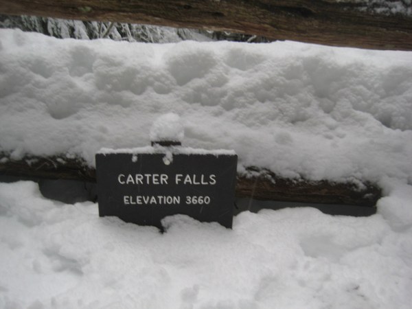
Before we knew it we arrived at Carter Falls. Carter Falls was named sometime between 1889 and 1895, in honor of Henry Carter, who had a seasonal residency on the Longmire property, a place where he often explored.
Carter, along with fellow entrepreneur Leonard Longmire, in 1882 built the Paradise Valley Trail and is considered one of the first entrepreneurial guides on Mount Rainier. He offered his services and packhorses to interested travelers wanting to explore the mountain. He took visitors along the Paradise Valley Trail for a small toll, from Longmire Springs, up past Carter and Narada Falls, to a viewpoint where adventurers could gaze down upon the Nisqually Glacier, to the much-desired Paradise Park. There, explorers could camp at the Camp of the Clouds, which hosted only seven tent sites including a cook’s tent in 1903. The demand was so high that by 1914, seventy tents were available, as well as other options. Wealthy explorers could stay in luxury at one of the two lodges located at Paradise Park.
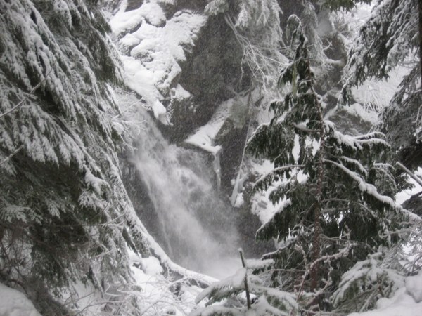 Carter Falls
The water source for Carter Falls is the Paradise River, which originates from the Paradise Glacier, the first major tributary of the Nisqually River. The falls drop a total of 53 ft. over two separate drops forming a delicate horsetail as it tumbles over boulders. What we could see of the falls were covered in mist bouncing off the rocks, frozen in time and space, delicately obscured by snow-laden trees. The view was magical.
After stopping to eat lunch and talk with a few folks, we decided not to venture up to Madcap Falls, which were only 50 more yards past Carter Falls. It was getting late and our turnaround time was fast approaching, so we decided that we would save it for springtime trip.
Between it snowing almost the entire time we were on the trail, and the great company, I felt we were in a purely magical winter wonderland; a perfect day.
I can see why this area would be a major tourist destination in the heat of the summer sun. Shaded by old trees and the mist coming off the waterfalls, this hike is an ideal hike for both winter snowshoeing and summer adventuring.
Happy adventuring to you!
Length: Our snowshoe distance was a total of 7.59 miles, roundtrip from Longmire
Elevation gain: 1300 ft., moderate hike / snowshoe
High point: 3650 ft
Passes: Annual National Park Pass $80.00, Mount Rainier Annual Pass $55.00, Day use fee $30.00 (for up to 7 days)
Note
- Drones are not permitted in Mount Rainier National Park.
- No dogs are permitted on the trails at Mount Rainier National Park. Dogs (on a leash) are allowed on paved roads and parking areas, basically, anywhere you can take a vehicle.
- Tire chain requirement for Mount Rainier National Park. Between November 1 and May 1, all vehicles in Mount Rainier National Park are required to carry tire chains. This requirement applies to all vehicle types in all weather and road conditions.
- Longmire to Paradise Road updates and information.
Bring
- Ten Essentials with a topographical (topo) map & compass. I suggest a carrying topo map: Green Trails Mount Rainier National Park 269S
- The National Park Service Map from Longmire to Carter Falls,
- Winter weather can change in an instant. Wearing, and bringing appropriate gear for winter mountain travel, and dressing in layers, can prevent hypothermia.
- Include gaiters, snowshoes and microspikes, avalanche gear if going off trail or into the backcountry: shovel, transceiver beacon, and probe.
- Don’t forget a camera to capture the landscape and fun memories.
- I really love bringing something hot and yummy for lunch, especially during winter adventures. One of my favorites lunches for a snowy cold day, is red curry and rice with a hot spiced chai to drink. My thought is, if you bring something yummy to eat, you will want to keep exploring even on a cold snowy day.
Directions
From Yelm Washington: follow WA-507 N 2.9 mi, Turn right onto WA-702 E 9.3 mi, Turn right onto WA-7 S/Mountain Hwy E 19.2 mi, Continue east onto WA-706 14.6 mi, East on SR 706 through Ashford to the Nisqually Entrance, Continue on Paradise Rd E to Longmire, park close to the Wilderness information center as the trail starts nearby.
Drive time: approximately 1 hr 34 mins, 62.6 miles
 Regina Robinson
