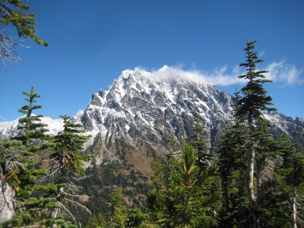
Lake Ingalls in the Alpine Lakes Wilderness is one of the most striking hikes for fall foliage. In fact, this area is stunning no matter what time of the year you go. In the spring the blooming flowers make a striking contrast against the craggy mountains, and in the fall the huckleberries are ripe, juicy, and delicious. Do not wait to hike this trail!
We undertook this hike in late September to hopefully get a break from the crowds on the trails the last five months. We left early (or at least we thought we left early!), arriving at the trail head just before 9am, only to find cars parked 50 ft or more from the actual parking lot. My hiking partners were more shocked than I. I resigned myself to hiking with the masses (I was part of the masses after all) as I laced my boots and mustered my courage to tackle the Lake Ingalls trail.
Although I’ve hiked the trail once before, I was fearful that my lack of inactivity and my health problems would keep me from reaching my destination. Perseverance is the key – along with a positive attitude from your hiking partners.
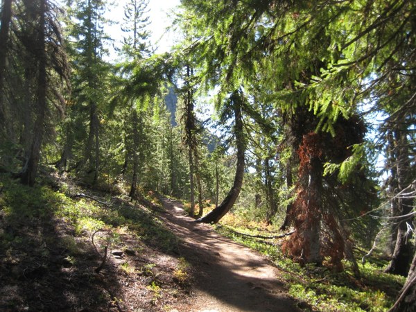 The Lake Ingalls trail winds through forests and meadows. Photo by Regina Robinson.
This trail starts from the parking lot following the North Fork of the Teanaway River for a short distance to where the trail branches. Left heads to Esmeralda Basin (a trail I have yet to hike), and right traverses a small meadow before heading sharply uphill to Lake Ingalls on trail #1390. This trail travels through several ecosystems, going from a forest filled with huckleberry bushes to a flat, scree-filled rock fest. Do not be alarmed; although it is steep in places, it is nothing that you cannot manage with short breaks, deep breathing, and a will to put one foot in front of another. The views are absolutely worth the adventure.
At two miles up another trail junction occurs. The left (straight) trail takes you upwards to Ingalls Pass and to Lake Ingalls, the right junction takes you up to Longs Pass, another trail that I have not taken yet, which connects to the Ingalls Creek Trail.
Going left, the trail traverses several scree and rocky patches before climbing up the ridge. We decided that a large rock outcropping was a great place to take a quick break before our final stretch to the top of the ridge. Here we took in the views and relished the deep blue skies and bright, warm sunshine. I could have taken a nap stretched out on that outcropping!
After our luxurious break, we packed and headed up to the pass rather quickly. At the top of the pass the trail then crosses the ridge at the wilderness boundary and enters the Wenatchee River Ranger District.
Stop and take in the views. Mt. Rainier and Mt. Adams were spectacular, as were the fall colors across Esmeralda Basin. Mt. Stuart was breathtaking as the wind whipped the fresh snow off the top of the mountain in lazy curls.
At this point we then had two paths we could take to Lake Ingalls. The right path (#1390.2) goes downhill and across the valley, and the left path (#1390.1) traverses through Headlight Basin.
After a brief photo op of Mt. Stuart, Ingalls Peak, and the valley below, we headed left to the traverse. Pick your way carefully downhill on the relatively short boulder trail, then head across the meadow and basin to the next uphill portion that leads to Lake Ingalls.
Headlight Basin afforded many places to stop and gawk at the scenery. The last time I hiked this trail was during a roaring thunderstorm, forcing us to practically run through the basin to get down off upper highlands. This time I took my time strolling through the meadow searching for late season blooms. I found my absolute favorite blue gentian amidst some yellow and orange leaved plants that I have not yet had time to identify.
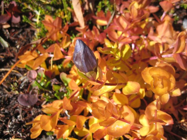 Mountain Bog Gentian. Photo by Regina Robinson.
Passing through the meadow, the trail leads across several boulder paths. Mind your step as some areas can be slick with muddy water. The trail was practically a muddy river at one point - I wished I’d stopped and put on my gaiters.
About 200 feet before a scrambling portion to the lake, the trail junctions again with the Lake Ingalls Way Trail #1390.2. This trail leads downhill to the right, traveling through several overnight backpacking spots. Keep left and head steeply uphill through the rocks. Follow the cairns, climbing up and over a rocky ridge that promptly opens up to wide vista where the views of Ingalls Peak and the west end of Ingalls Lake stop you in your tracks. Here, hike downhill to view the deep blue lake and the outstanding views that the Alpine Lakes Wilderness is known for.
Yes, there were more people at the lake and on the trail than I’ve seen before, but even with all the people, it really didn’t seem like too many folks at all (maybe because everyone was so spread out). Usually with that many people, you see tons of trash and toilet paper all over the trails. Thankfully we hardly saw any trash at all. That day I picked up four pieces of microscopic trash; remnants of a protein bar, a gum wrapper, and one orange peel. I am thankful and grateful that people are valuing and taking care of this divine area by practicing the Leave No Trace principles.
For our lunch spot we choose a high rock close to the lake because of the views it would afford us. Here we sat eating, laughing, talking, and expounding on the virtues of nature, when a young women walked by below us, saying that we “had chosen the best lunch hangout on the lake!” We agreed and asked her if she would mind taking our photo. She didn’t. She managed to catch this wonderful photo of us. After the young woman left we sat in silence, meditating on the magnificent beauty before us. I hope that each of you can experience the stark beauty of this alpine lake region. Even in silence nature speaks.
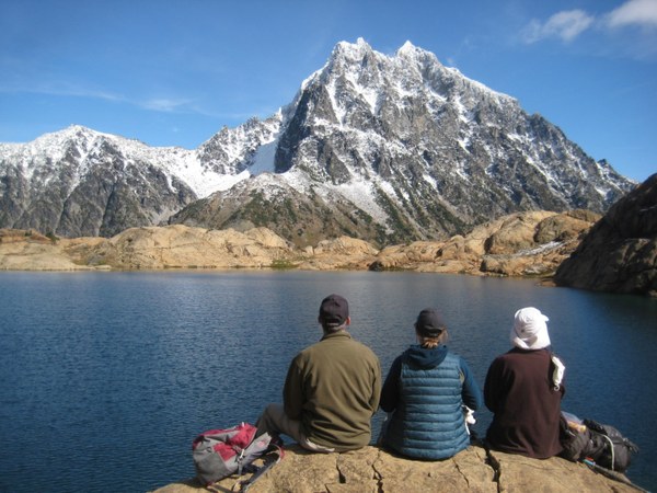 My fellow adventurers and I enjoying the view of Lake Ingalls and Mt. Stuart on a glorious fall Sunday. Photo courtesy of Regina Robinson.
After lunch, it was difficult to leave that sunny spot at the lake. We explored the area by climbing up the rocks behind us, and following a short crack in the ground to that had melt water flowing through it. I wished I could have stayed overnight! The lake and area surrounding it is really worth staying an extra day or two to explore. There is so much to see and do.
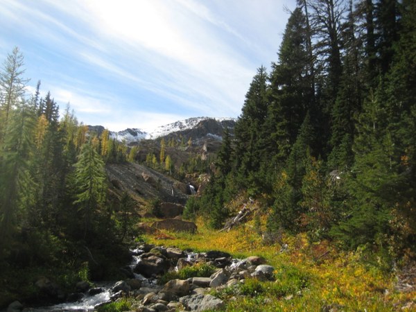 Lake Ingalls Way Trail #1390.2. Photo by Regina Robinson.
three hours, not bad for a steep hike and not being in the optimal of shape. I felt extraordinarily slow compared to my friends. I realized though, I do not need to hike fast to be a great hiker, I just have to go at my own pace. I’ll get there. The views are worth it. All I need to do is keep making the effort, one step at a time.
Our downhill descent was set at a much faster pace than my uphill climb. Some of us had to work in the morning, and with a three hour drive home, we did not want to linger too long. Even with my bad knees we made the car in two hours. Heading back to the car after a day of adventuring is when most accidents happen. This is when the most care should be taken to avoid unnecessary injuries. Even being mindful, I found myself tripping over roots and rocks because I was not picking my feet up. A fall could have lead to disastrous consequences, so I slowed up.
For dinner on the run, we stopped and ate at Twin Pines Burgers in Cle Elum. My friend had a veggie burger and a boysenberry shake, I had a BBQ burger and a habanero lime milkshake, and we shared fries. Both shakes were delicious! The habanero lime tasted like a spicy margarita. Twin Pines only takes cash, no credit/debit cards, although there is an ATM in their lobby to make purchases easier. It was expensive meal as far as burgers go, but so worth it because of the quality and commitment to the product they serve and the friendly service they offer.
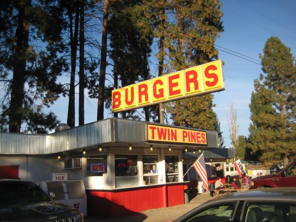 Twin Pines restaurant. Photo by Regina Robinson.
At work on Monday, all I could think about was how truly lucky we are to live in such a wonderful state. Washington State offers so many opportunities for us to commune with nature to nurture our weary souls. Where will you adventure too? Please let me know where you find nature’s peace and solace.
Trip Info
Length: 9 miles roundtrip
Gain: 2500ft
Highest point: 6500ft
Pass/parking fee: Northwest forest pass
Pets: Dogs are prohibited on the Lake Ingalls Trail.
Bring: 10 Essentials, a camera, a hat, sunglasses, and other protective sun gear as much of the hike is exposed.
Notes
- Both the Forest Service and The Mountaineers want us to recreate safely and responsibly during COVID-19. The Mountaineers has guidelines in place for recreating with COVID-19. Of the 100+ people we saw, all but eight had their masks on and were following proper social distancing. Please take precautions folks, we want you around to recreate and play in our beautiful state.
- The Alpine Lakes Wilderness is impacted by nearly 150,000 visitors each year, with little to no understanding of wilderness ethics. In order to preserve the integrity of the wilderness it is important to follow wilderness regulations and using Leave No Trace principals to keep our trails enjoyable for all that come after us.
- Before you visit the Alpine Lakes Wilderness, check with the Wenatchee Ranger District in Leavenworth, WA, (509) 548-2550, or the Cle Elum Ranger District in Cle Elum, WA (509) 852- 1100, or visit their online website for current conditions and restrictions.
- If the trailhead is full, park ONLY on the west side of the road (it is signed "Parking This Side Only") to allow safe traffic flow. We witnessed cars parking down both sides of the road, which made it nearly impossible to drive back down the road after we were done with our hike. There were cars lining both sides of the road for almost a mile.
Directions
From Olympia WA we took I5 north to SR 18, to Eastbound I90.
From eastbound I-90, take Exit 85. Cross the freeway on the overpass and turn right onto Highway 970. Drive on 970 for 7 miles, then turn left onto Teanaway Road.
Drive for 7.1 miles, then bear right as the road becomes North Fork Teanaway Road. 5.9 miles past this fork road becomes unpaved. At this point take the right fork to Forest Road 9737. Drive 1.1 miles and stay left at the fork signed Beverly Campground. Continue on this road and keep right at a fork signed for 'Trail 1394'. Drive another 1.7 miles to the trailhead. It is 22.5 miles to the Esmeralda Basin/Ingalls Lake trailhead from the turn off of Highway 970.
 Regina Robinson