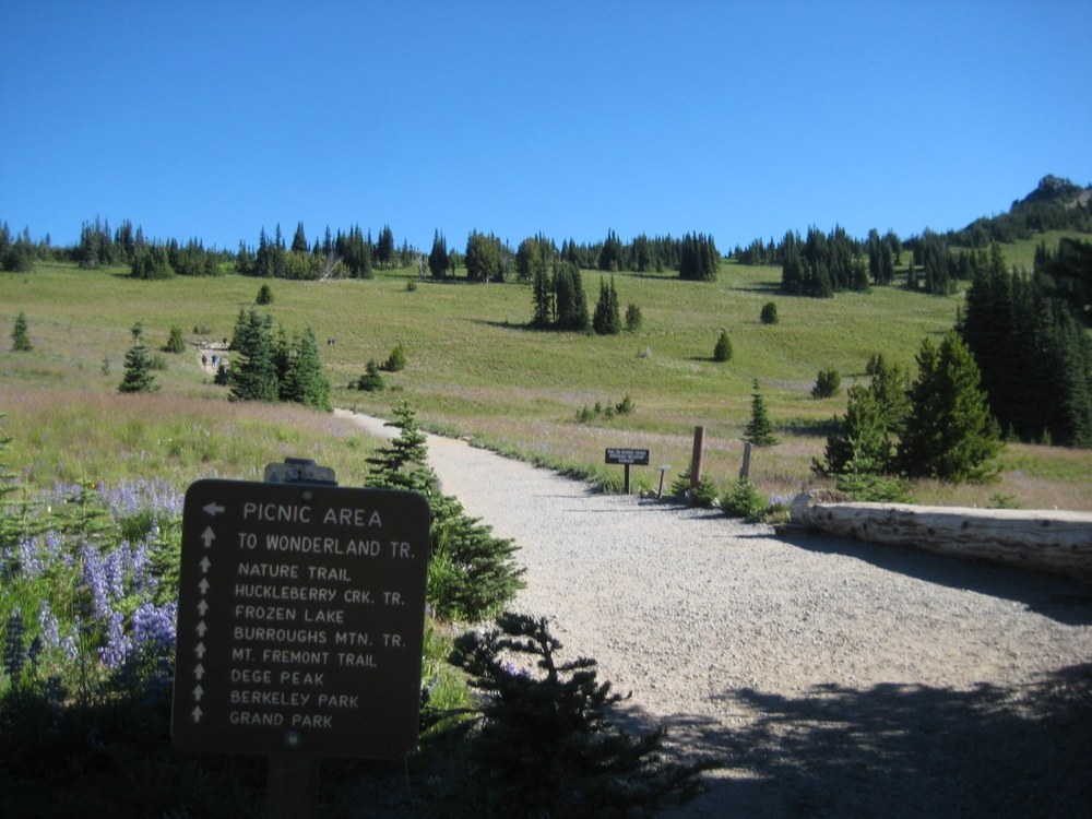
Mt. Rainier’s Yakima Park, aka Sunrise, is the highest drive-able point in the national park at 6,400 ft. Sunrise is second to Paradise when it comes to popularity, but Sunrise offers a drier, sunnier climate, impressive views, and plenty of opportunity for adventure.
Mt. Lookout
Our loop trail starts off at the Sunrise parking lot, heading west onto the Sourdough Ridge Trail. Take this trail to the five-way junction at Frozen Lake, from there; take the trail northwest up to Mt. Lookout. This is a great place to sit down, eat lunch, and enjoy the views.
Head downhill to the junction, this time take the trail to Berkley Park. The trail for the First Burroughs heads uphill on a rather steep rocky slope. When you reach First Burroughs, take in the views, take photos and look around.
Instead of heading up to second and third Burroughs, this loop drops you from First Burroughs down onto the Sunrise Rim trail that heads southeast across the barren landscape. Traverse downhill to another junction at Shadow Lake. Proceed past Shadow Lake taking the trail heading eastward to the right of the lake. Continue through flower filled meadows until the last junction is reached, and take the left trail to the south side of the Sunrise Visitor Center parking lot.
Sourdough Ridge Trail
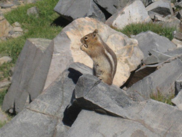
As we hiked, watching the family of deer below us, I began to notice a trail of golden fish crackers. At first I was mad, “Who is leaving a trail of crackers and feeding the chipmunks?” A little over a third of way to Frozen Lake, we came across a large family with very young children in tow, the children were absolutely delighted that the little critters kept coming up to them and begging for food.
While I stopped to take photos of the plants and this cute little chipmunk, the family, visiting from out of state, asked about the area. We had a lovely conversation about child friendly hikes and the importance of keeping the wild in wildlife. The discussion was a learning opportunity for both of us.
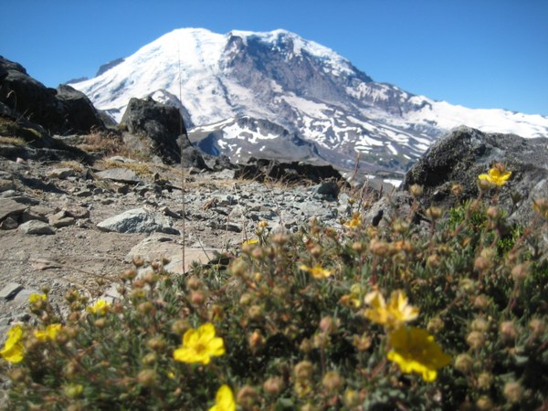
We chose to head up to Mt Freemont Lookout. I stopped often to take photos of scarlet paintbrush, alpine lupine, shrubby cinquefoil, and agoseris found amidst the rocks.
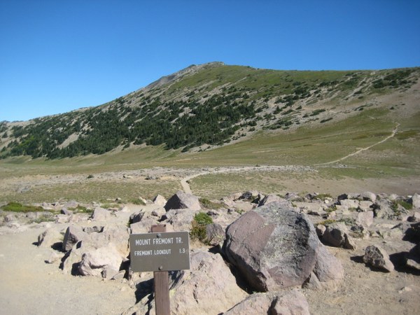
At the five way trail junction near Frozen Lake, take the right hand trail that skirts just west of Frozen Lake, head up to the old fire lookout, you will not be disappointed. Although the trail starts off gently, it does get steep. Keep going though, as the views are worth it. Panoramic views of the Cascades, Mount Rainer’s spectacular meadows, Redstone Peak, Skyscraper Mountain, and the Olympics await you.
Length: This loop is an approximately 8-mile-loop with exploration around Shadow Lake. If you throw in Dege Peak, before or after heading towards Mt. Freemont Lookout, it will add another 4.2 miles.
Gain: 1,100 ft.
Highest point: 7,181 ft.
Pass/parking fee: America the Beautiful Interagency pass or Mt. Rainier Annual Pass, Senior pass, or pay the $30/car, $15/person walk-bike in, $25/motorcycle
Pets: Not allowed unless it is a Service dog. Pets in the park are allowed in parking lots, in campgrounds, and on paved roads only. Pets must be leashed, no more than 6 feet, and no more than 25’ from paved road or paved trail. If you would like to hike with your dog, the National Forest offers many great trails so does Alta Crystal Resort or Crystal Mountain: Dog Friendly Hikes
Bring: 10 Essentials, mountain weather can change in an instant- wet, cold weather can occur anytime of the year. Snow usually remains between 5,000 to 8,000 feet well into mid-July (we saw plenty on our excursion-always be prepared); a camera; binoculars – be on the lookout for mt goats on the snow and rocky crags, black bears in the meadows, and climbers on the Emmons Glacier.
Carry extra water- the day we hiked this loop, it was 89 degrees in the park. With all that barren ground and even though we saw snow, temperatures were more likely in the upper 90’s. Heat exhaustion and heat stroke are no joke. There is little shade and no water sources, until you reach Shadow Lake, which is towards the end of the loop, if you choose to hike counter clockwise. Frozen Lake is the water source for the Sunrise Visitor Center and is not accessible as a water source.
With the amount of people on the trails lately, practicing LNT helps to keep our trails enjoyable for all that come after us.
first Burroughs
From the Sunrise parking lot the roundtrip is 4.8 miles, with an elevation gain of 900’, we instead of returning to the parking lot on the Sourdough Ridge trail, we opted for hiking up to the First Burroughs. Hiking to the Burroughs, the mountain is so close it is almost like you can reach out and touch it; pictures here often look unreal as the mountain is really that close.
The Burroughs is an old andesitic lava flow. The whole area looks barren. The landscape is dry, dusty, littered with pumice, tephra, and ash. The heat radiates off the rocks like an oven. The plants thrive in the harsh- rocky landscape often looking twisted, or crooked. Many of them are huddled together to form clumps or dense mats. Clumping helps to protect them from searing hot sun, harsh wind, snow, and rain.
Sunrise Rim Trail
Out and back from the Sunrise parking lot this trail is 5.2 miles, with an elevation gain of 1000’. From First Burroughs we chose to head back towards our car via the Sunrise Rim Trail. favorite way to hike this trail is counter clockwise. like hiking up to First Burroughs, and then hiking down the Sunrise Rim Trail.
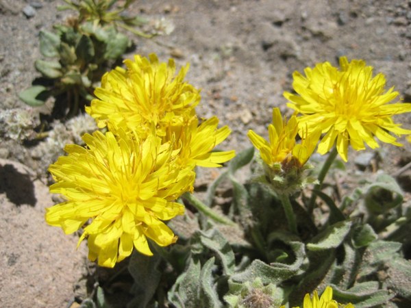
The trail winds downhill through fragile alpine tundra. In some areas it is wide, dusty and rocky with plenty of room for people to pass, then you turn a corner and it becomes a scree field with unstable rock and steep drop offs.
The area you are walking through is similar to the tundra zones found in the arctic regions of the world. It is under heavy snow and ice up to nine months a year. It is critical to stay on the trail, not to pick flowers, or remove rocks. Alpine soil and vegetation are easily damaged by curious visitors.
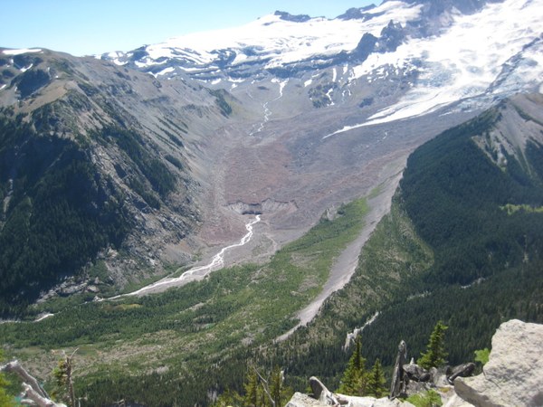
To see the snout of Emmons Glacier is both amazing and horrifying. At one time the glacier was over 60 kilometers long. Near the White River Campground, the moraines in the valley indicate that the glacier would have been approximately 300 meters deep or 1,000 ft thick.
After spending a good amount of time at the vista, we made our way down hill coming out into the first of three meadow areas. The sight was unbelievable. With lupine, sitka valerian, paintbrush, sickletop lousewort, and asters, the amount of wildflowers was stunning. continued on trail coming into the second meadow, equally stunning with tons of asters on display.
Moving uphill we continued past meadows that showcased paintbrush, lovage, and daisies. The last junction came about 200 feet from the parking lot, the trail splits uphill to Sunrise Visitor center and downhill, follows the Silver Forest Trail.
Directions:
From Enumclaw, follow SR410 east for 43 miles, until you reach Sunrise Park Rd/White River Rd, veer slight right at the fork and follow for 5 miles along the White River. As the road enters the park it begins it switchback climb to Sunrise. Leave plenty of time to stop at Sunrise Point a short distance from the Sunrise Visitor Center.
Note: With the high volume of visitors to Mt. Rainier this year, be well prepared. Lines and wait times can be long. We saw 5 miles of cars just trying to enter as we left at 4pm. stroom facilities were packed and very dirty. Very few individuals took the time to clean up after themselves, I found it shocking and disheartening as I’m a frequent visitor to Mt. Rainer.
Dinner in Greenwater was great, the wait times were not too bad, however, please be prepared: make sure your vehicle is running well, fully gassed, have food and water in vehicles along with 10 essentials and extra clothing, have cash and a credit card, we found that one place didn’t take cash and the other place only took cash. th that in mind, during this “new normal” expect delays and be prepared for the unexpected.
 Regina Robinson