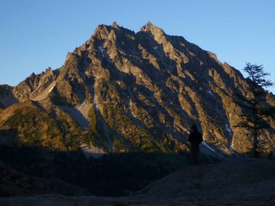
Mount Stuart/West Ridge
The West Ridge route on Mount Stuart is Grade II, 5.4.
getting there
Drive I-90 to exit 85, turn left to join SR-970. Drive 6.6 mi and turn left on Teanaway River Road. Follow north fork road approximately 23 mi to end of road at 4,243 ft.
APPROACH
Take this trail to Ingalls Pass, 6,480 ft, and on to Ingalls Lake. (Some parties take an earlier cutoff and go to Long’s Pass, then on down to Ingalls Creek, instead.) Descend to Ingalls Creek; cross the creek on a log bridge. At upper meadows of Ingalls Creek, short of Stuart Pass, ascend to base of West Ridge.
Occasionally, parties opt to overnight in meadows near head of creek, to get an earlier start on the climb itself. Most parties do this climb as a carryover, with a bivy near the summit.
ASCENT ROUTE
Ascend scrub and enter a deep gully on the lower ridge, the middle of three parallel gullies. This gully has a big rock “like a house” at its base. Climb up and to the right. At the end of the gully scramble through the notch and look at Long John Tower. Climb up chimney to left of the tower; it is about 3/4 a pitch with a chockstone near the start.
Continue up to a notch where you will see the ridge crest and the west ridge tower; continue to the base of the tower. There are ledges around the right (south) of the tower with an airy step on the south. Do not go to the ridge crest itself, but scramble on benches about 50 yards below the crest.
Scramble to the West Ridge Notch. Just south of the notch, climb up easy blocks (class 4) for one full rope length. Head to the right ridge and up about 20-30 ft.; traverse left via some airy steps, but with solid holds, about half a rope length. Then climb up obvious chimney for about half a rope length, and traverse right to a crack with a chockstone at the top.
Scramble to below summit block, then traverse down and along benches to the south. At the end make a slightly rising traverse until no more traversing can be done, and climb up a chimney for half a rope length. Then scramble up one rope length to another chimney. This last pitch is about half a rope length, and look for the two pitons in the chimney.
DESCENT ROUTE
Scramble to the false summit. Descend steep snow or scree then keep right through sparse trees to enter the Cascadian Couloir, descended to the valley floor. From the base, hiking west on Ingalls Creek Trail a short distance will bring you to a fork. The left crosses Ingalls Creek and climbs over Long’s Pass. The right leads back to Ingalls Lake.
TRIP PROFILE
| SEGMENT | TIME (HR) | ELEVATION GAIN (FT) |
|---|---|---|
| Seattle to Trailhead | 2.5 | |
| Trailhead to Climb | 4-6 | 2,500 |
| Climb to Long John Tower | 4 | 1,000 |
| Long John Tower to West Rib Notch | 4-5 | 350 |
| West Rib Notch to Summit | 4-6 | 400 |
| Summit to Trailhead | 7 | 1,000 |
EQUIPMENT
Small rack to two inches, ice ax in early season.
NOTES
This athletic climb is largely scrambling on a huge granite massif. Fast efficient parties who travel light are favored. Routefinding dilemmas tend to occur at Long John Tower, at exposed section of West Ridge Notch, and in descent (not staying right). Snow patches along the route should be utilized for drinking water.
Large rats, also known as, snafflehounds, inhabit the summit bivy area, so be careful about anything (including boots) with salt on it; they will try to eat it. Most of route is traveled unroped. The key to this climb is traveling light. Contact Leavenworth Ranger Station for updated backcountry regulations for the area.
- Suitable Activities: Climbing
- Climbing Category: Intermediate Alpine
- Seasons: May, June, July, August, September
- Weather: View weather forecast
- Difficulty: Intermediate Rock Climb
- Elevation Gain: 5,250 ft
- 9,415 ft
-
Land Manager:
Okanogan-Wenatchee National Forests
Alpine Lakes Wilderness
- Parking Permit Required: Northwest Forest Pass
- Recommended Party Size: 12
- Maximum Party Size: 12
- Maximum Route/Place Capacity: 12
- Green Trails Mt Stuart No. 209
- USGS Mount Stuart
There are no resources for this route/place. Log in and send us updates, images, or resources.
