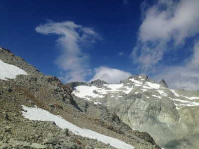
Mount Daniel
A scramble of 16 miles with 5,200 feet of gain in the Alpine Lakes Wilderness. Scramble Mount Daniel, nearby Lynch Peak or both.
getting there
From Cle Elum, take SR 903) to Salmon La Sac. A few yards past the Ranger Station, keep right on a rough dirt road (Forest Road 4330). Drive about 12 mi to the end of the road and the Cathedral Rock trailhead (3,350 ft).
approach & ascent
mount Daniel (7,986 ft)
16 miles round trip with 5,200 feet of elevation gain
difficulty: strenuous 5, technical 4
Follow the Deep Lake trail 4.5 miles to Cathedral Pass (5,500 ft). As you descend towards Deep Lake, there is a good trail leading towards Peggy's Pond at the end of a switchback. The path traverses to the lake. From the lake there is a path most of the way to Mount Daniel after the snow melts. The path is along the southeast ridge that is between Circle Lake and the permanent snowfield shown on the USGS map. Follow the ridge to the saddle below the east summit (7,899 ft). The east summit is an enjoyable scramble along its south ridge if time permits. Traverse from this saddle to the saddle between the east and middle summits. From here walk up the talus slope to the middle summit, and then follow the southeast ridge of the west summit to the base of the summit block. Scramble along the south side to reach the summit.
lynch peak (7,280 ft)
16 miles round trip with 4,400 feet of elevation gain
difficulty: strenuous 5, technical 4
Approach as for Mount Daniel to Peggy's Pond at 5,600 ft. From the pond, ascend northwest to ~5,800 ft, then north to ~6,300 ft. Travel at ~6,300 ft to the saddle east of Pea Soup Lake. Much of this long traverse is north facing and may require crampons. From the end of Pea Soup Lake, ascend Lynch Peak, avoiding steeper terrain as necessary.
Notes
- These scrambles can be done in a day or in two days with a camp near Peggy's Pond, but the mosquitoes can be ferocious in late July and early August.
- Suitable Activities: Scrambling
- Seasons: June, July, August, September
- Weather: View weather forecast
- Difficulty: Strenuous 5, Technical 4
- Length: 16.0 mi
- Elevation Gain: 5,200 ft
- 7,986 ft
-
Land Manager:
Okanogan-Wenatchee National Forests
Alpine Lakes Wilderness, Skykomish Ranger District (MBSNF)
- Parking Permit Required: Northwest Forest Pass
- Recommended Party Size: 6
- Maximum Party Size: 12
- Maximum Route/Place Capacity: 12
- Green Trails Alpine Lakes West (Stevens Pass) No. 176S
- USGS Mt Daniel
- USGS The Cradle
This is a list of titles that represent the variations of trips you can take at this route/place. This includes side trips, extensions and peak combinations. Not seeing a title that fits your trip? Log in and send us updates, images, or resources.
- Lynch Peak
- Mount Daniel & Lynch Peak
There are no resources for this route/place. Log in and send us updates, images, or resources.
