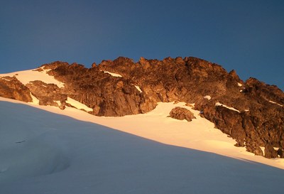
Mount Logan/Banded Glacier
Mount Logan via the Banded Glacier is moderate technically but a very strenuous route in the North Cascades.
GETTING THERE
Take I-5 to just north of Mount Vernon, then go east on SR-20 (North Cascades Highway) to Marblemount. Sign in and get permit at Marblemount Ranger Station. Continue east on SR-20 to Colonial Creek Campground.
APPROACH
Follow Thunder Creek Trail for 9 miles to junction with Fisher Creek Trail. Hike about 3 miles on Fisher Creek Trail to just past a good log bridge with a handrail over stream that drains lake at 5,160 ft. Hike up this drainage to camp at lake. After turning off Fisher Creek Trail, stay close to stream on ascent to basin.
ASCENT ROUTE
From camp, ascend south-southeast to low point on ridge (possibly Christmas Tree Col); may need to rope up for steep snow or short glacier segment. From col, drop down to Banded Glacier and ascend to the Banded-Douglas Col, then climb snow to the summit. 1.5-2 hr on glacier. A large bergshrund at the top of the glacier is traversed on the left. Follow snow and rock to summit block. Some class 4 climbing is required to reach a small summit area.
DESCENT ROUTE
Descend the climbing route.
TRIP PROFILE
| SEGMENT | TIME (HOURS) | ELEVATION GAIN (FEET) |
|---|---|---|
| Trailhead to Camp | 10 | 3,100 |
| Camp to Summit | 6-8 | |
| Summit to Camp | 4-5 | |
| Camp to Trailhead | 7-9 |
EQUIPMENT
Standard glacier equipment.
NOTES
This climb is 42 miles round trip. It should only be attempted by very strong parties if planning to do it in three days. Most parties would prefer to do it in four days. Not recommended in late season. A large bergscrund develops at the top of the glacier. Also, in late season, there is more loose rock, ice, and exposure.
An alternate route, via the Fremont Glacier, may be done for Basic Alpine credit. Its approach is from either Park Creek Pass or up the Thunder Creek Trail to near Park Creek Pass. North Cascades National Park has a party limit of 6 in this area.
- Suitable Activities: Climbing
- Climbing Category: Basic Alpine
- Seasons: June, July, August
- Weather: View weather forecast
- Difficulty: Technical 3, Strenuous 5, Basic Glacier Climb, Basic Experience Climb
- Length: 42.0 mi
- 9,087 ft
- Land Manager: North Cascades National Park
- Parking Permit Required: None
- Recommended Party Size: 6
- Maximum Party Size: 6
- Maximum Route/Place Capacity: 6
- Green Trails North Cascades Ross Lake No. 16SX
- USGS Ross Dam
- USGS Forbidden Peak
- USGS Mt Logan
- Trails Illustrated North Cascades National Park
There are no resources for this route/place. Log in and send us updates, images, or resources.
