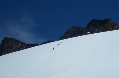
Mount Logan/Fremont Glacier
A remote peak in the North Cascades, Mount Logan is a great multi-day climb with little technical difficulty and lots of backcountry travel.
getting there
Drive east on SR-20 (North Cascades Highway) to Marblemount. Sign in and get permit at Marblemount Ranger Station. Continue east on SR 20 to Colonial Creek Campground (1,200 ft).
APPROACH
Follow Thunder Creek Trail for 18 mi to large, flat, sandy meadows 0.3 mi north of Park Creek Pass. Go E and up into moraine of glacier remnant 500' to large, flat, sandy, protected camp at about 6,350 ft.
ASCENT ROUTE
Ascend on a gradual traverse for 2 mi northward, around a broad ridge, then up to the gentle Fremont Glacier at 8,000 ft. Terrain is open heather and high alpine meadow and rock fields. Ascend glacier northeast towards the middle of the shallow cirque formed by Mount Logan's true summit and middle Peak (at the south end of the cirque). Ascend a snow finger up the middle, or left-middle, of the rock face of the cirque and scramble broken rock up and left to the low pass in the summit ridge. Cross to east side of summit ridge and traverse north for 0.3 mi on generally solid rock and boulders, staying below ridge crest. A final short, steep rock scramble leads to summit.
DESCENT ROUTE
Descend the climbing route.
TRIP PROFILE
| SEGMENT | TIME (HOURS) | ELEVATION GAIN (FEET) |
|---|---|---|
| Trailhead to Camp | 6-8 | 4,460 |
| Camp to Summit | 5-8 | 4,330 |
| Summit to Camp | 2-3 | |
| Camp to Trailhead | 2-3 |
EQUIPMENT
Standard glacier equipment.
NOTES
- The snow finger may melt out in late season, leaving a bergschrund problem - the diagram on p. 311 of Cascade Alpine Guide, Vol. 3 is helpful.
- The traverse along the summit ridge varies between Class 2, 3 and 4. Several sections are steep and exposed, and some may want a belay.
- A beautiful alpine climb, but the approach is very long for a three day trip.
- Alternative Approach: Drive to Lake Chelan. Take ferry to Stehekin. Sign in and get permit at Stehekin Ranger Station. Take shuttle bus and/or walk 18.5 mi to Park Creek trailhead (2,300 ft). Hike 8 mi to Park Creek Pass (6,100 ft) and continue thru pass to off-trail camp at 6,350 ft.
- Can be used as an up-an-over climb from the Banded Glacier and Douglas Glacier climbing routes.
- Suitable Activities: Climbing
- Climbing Category: Basic Alpine
- Seasons: July, August, September
- Weather: View weather forecast
- Difficulty: Basic Alpine Climb, Basic Experience Climb
- Length: 47.0 None
- Elevation Gain: 8,900 ft
- 9,087 ft
- Land Manager: North Cascades National Park
- Parking Permit Required: None
- Recommended Party Size: 6
- Maximum Party Size: 6
- Maximum Route/Place Capacity: 6
- Green Trails North Cascades Ross Lake No. 16SX
- USGS Ross Dam
- USGS Forbidden Peak
- USGS Mt Logan
- Trails Illustrated North Cascades National Park
There are no resources for this route/place. Log in and send us updates, images, or resources.
