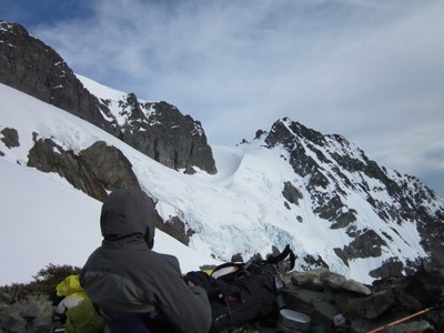
Mount Shuksan/Fisher Chimneys
A mixed glacier and 4th class rock climb/scramble, a bit more challenging than the Sulphide Glacier route, and joining the Sulphide route on the summit pyramid. This route is the one most often seen on photographs of Lake Ann and Shuksan. Rockfall is a concern in the chimneys. Times: 2-3 hr trailhead to camp, 7-8 hr camp to summit.
getting there
Drive I-5 to Bellingham. Take SR-542 past the Mount Baker Ski Area as far as the road goes depending on the time of year.
APPROACH
Hike south on Lake Ann Trail over Austin Pass (4,700 ft). Trail may be snow covered in early season. At about 2 mi, cross small creek and hike up small stream and over ridge southeast (4,800 ft) to camp at Lake Ann.
ASCENT ROUTE
Follow a trail toward the lower Curtis Glacier. It switchbacks, crosses two gullys, and becomes obscure just before the entrance of the first chimney. Find a clear trail through the chimneys, approximately 1,000 ft of class 3-4 scrambling.
Ascend the first chimney for about 200 ft. Below a difficult step exit right and continue up ridge. Traverse right across a heather slope, and out onto a small ridge (dry bivy site). Traverse across a large talus field, gaining about 100 ft, to a gully on the far side.
Climb the gully past two class 3-4 steps and short traverses and up a longer, straight section. Traverse for about 70 ft, then turn left up a side gully 100 ft to where the route tops out on the ridge.
Climb easy snow and rock, then climb 150 ft up a slope of steep snow or ice (Winnie's Slide, incorrectly labeled on the map), and cross through the ridge onto the Upper Curtis Glacier. Ascend/traverse the glacier, working left around crevasses. Turn right (south) and make a descending traverse toward Hell's Highway (incorrectly labeled "The Hourglass" on the map). Ascend Hell's Highway then the Sulphide Glacier to the base of the summit pyramid, which can be climbed by the right skyline or by a gully up the center (exposed class 4, 600 ft).
DESCENT ROUTE
Descend along the northwest edge of the Upper Curtis Glacier until you can cross to the White Salmon at about 7050 ft. Descend a short steep slope at the top of the White Salmon then keep left, following below the crest of Shuksan Arm on easy rock and snow for a short distance until you come to place where you can cross to the south side of the ridge. Pick up a clear trail and descend 150 ft, turn right, traverse, descend another several hundred feet, finally coming out at the edge of a talus slope. Cross the slope, losing no more than 100 ft, and pick up the clear trail as it crosses heather slopes. The trail descends onto a ridge then turns right and enters a gully. At the bottom of the gully pick up the trail to Lake Ann.
TRIP PROFILE
| SEGMENT | TIME (HR) | ELEVATION GAIN (FT) | Elevation loss (Ft) |
|---|---|---|---|
| Seattle to Trailhead | 2.5 | ||
| Trailhead to Camp | 2-3 | 1,500 | 800 |
| Camp to Summit | 7-8 | 4,450 | |
| Summit to Camp | 5-6 | 4,450 | |
| Camp to Trailhead | 2 | 800 | 1,500 |
EQUIPMENT
Standard glacier equipment.
NOTES
- Both the popularity and rockfall risk on this climb can create dangerous situations. Watch for rockfall in the chimneys and take special care on the summit pyramid gully because of loose rock and multiple parties.
- Six people is the recommended party size for this climb. Consider the experience of your party and ensure you have adequately experienced climbers to supervise/assist less experienced climbers through the bottlenecks and rockfall hazards presented on this climb.
- Requires good physical condition and endurance.
- A higher camp is feasible below the chimneys at ~5,600 ft. There are also bivy sites above the chimneys, both above and below Winnie's Slide, with access to running water.
- Variations are possible, and even likely, in the chimneys.
- Suitable Activities: Climbing
- Climbing Category: Basic Alpine
- Seasons: July, August
- Weather: View weather forecast
- Difficulty: Basic Experience Climb
- Elevation Gain: 6,750 ft
- 9,127 ft
-
Land Manager:
North Cascades National Park
Stephen Mather Wilderness
- Parking Permit Required: Northwest Forest Pass
- Recommended Party Size: 6
- Maximum Party Size: 12
- Maximum Route/Place Capacity: 12
- USGS Mt Shuksan
There are no resources for this route/place. Log in and send us updates, images, or resources.
