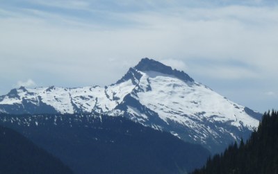
Sloan Peak/Corkscrew Route
An alpine climb with both glacier and rock climbing skills (Class 3) needed. Sloan has a distinctive profile and the corkscrew is a unique feature: a good tread on a sloping shelf in the middle of large cliffs. Snow can make the approach a challenge while late season climbs may have trouble with the glacier. Times: 4-5 hr to camp, 5-6 hr to summit.
getting there
Bedal Creek
Drive the Mountain Loop Highway to 18.25 miles south of Darrington (~1 mile south of the Bedal Campground) or 7 miles north of Barlow Pass, and turn left onto Forest Road 4096. Drive 3 miles to the trailhead (2,800 ft). High clearance 4WD vehicles are recommended for a short, steep, and narrow section of Forest Road 4096 between the fifth and sixth switchbacks.
Cougar Creek
Drive the Mountain Loop Highway, to 17 miles south of Darrington and turn left onto the North Fork Sauk River Road. (Note: If you reach Bedal campground before turning onto this road you have gone 0.25 mile too far). Drive 4.5 miles to a pull out just past Garnet Creek (1,900 ft).
APPROACH
bedal creek
Hike the trail to 3,560 ft (1.2 miles), just before a major side stream. Head up slope in the trees. At ~4,500 ft a minor flat area is reached. Follow it toward the 5,300 ft saddle between Bedal Peak and Sloan Peak. Just before reaching the open area (drainage), ascend in the trees to 4,800 ft. Then up to approximately 5,000 ft in brushy areas.
At ~5,000 ft traverse the open/bushy slope to the timber to the saddle (pass by the small lake). Head up to the base of the Glacier. Camp on the saddle at 5,330 ft or on ridge overlooking the glacier at 5,800 ft. Be prepared to camp on snow through June.
cougar creek
There are three crossings of the north fork of the Sauk River in the first one-half mi. All of them have log bridges in place which are pretty easy. Be careful to find the trail to the left after the 1st and 3rd crossings. Trail No. 648 is somewhat brushy and there are plenty of downed trees, but it quite adequate. It is easy to follow in most places and flagged where it becomes harder to follow. Beautiful campsites exist between 5,000 and 5,300 ft.
A climbers trail continues on up into the rocks. It is possible to stay on rocks to a high point on the glacier, making the glacier travel component a low angle traverse.
ASCENT ROUTE
Descend to the glacier. Head southwest for the obvious corner where the left skyline of the summit massif joins the east ridge. Keep high (right) on the glacier, then ascend left to within 100 feet of the east rock face. Watch for evidence of rock fall from the face and move to the left if necessary.
Later in the season, it may be necessary to drop down lower on the glacier to avoid major crevasses. From the corner, follow a rock and heather covered shelf on an obvious goat/climber trail, high across the entire south face, around the corner and partway to the west face, to a prominent gully. Ascend straight up gully to its top at the ridge crest. Move east (left) just below the ridge, go up a short steep step (Class 4), and scramble 200-300 feet to summit.
DESCENT ROUTE
Descend the climbing route.
TRIP PROFILE
bedal creek
| SEGMENT | TIME (HOURS) | ELEVATION GAIN (FEET) |
|---|---|---|
| Trailhead to Camp | 4-5 | 3,000 |
| Camp to Summit | 5-6 | 2,100 |
| Summit to Camp | 2-3 | |
| Camp to Trailhead | 2 |
cougar creek
EQUIPMENT
Standard glacier and rock equipment, including helmet.
NOTES
- A one-day trip (13-14 hr) is very reasonable for fit parties. If approaching on Sauk River, be sure to do the log crossings on the return before dark.
- Getting from the glacier to the rock can be difficult in late season. The rock and heather shelf can be a problem if wet or snow-covered. The route description in Cascade Alpine Guide, Vol. 2 for the upper rock portion is of questionable accuracy.
- Approaching the summit avoid the temptation to head directly for it, stay to the right instead and reach the ridge, then go across to the summit. Scrambling is almost always 2nd class with very few 3rd class moves required. The last 15 feet is 3rd class scrambling If you find anything harder you are off route.
- If you are too early, the route through the heather benches of the upper mountain will be covered by snow and routefinding will be very tough. If you are too late the glacier will be impassable.
information for leaders
Scheduling
The Corkscrew Route may be listed as a Basic Glacier Climb or Basic Alpine Climb, depending on current conditions. Leaders should highlight this in their trip description and be sure to choose the correct activity template.
- Suitable Activities: Climbing
- Climbing Category: Basic Alpine
- Seasons: July, August, September
- Weather: View weather forecast
- Difficulty: Basic Alpine Climb, Strenuous 2, Technical 2, Basic Experience Climb
- Length: 12.0 mi
- Elevation Gain: 5,900 ft
- 7,835 ft
-
Land Manager:
Mount Baker-Snoqualmie National Forest
Henry M Jackson Wilderness, Skykomish Ranger District (MBSNF)
- Parking Permit Required: Northwest Forest Pass
- Recommended Party Size: 12
- Maximum Party Size: 12
- Maximum Route/Place Capacity: 12
- USGS Sloan Peak
- Green Trails Mountain Loop Highway No. 111SX
There are no resources for this route/place. Log in and send us updates, images, or resources.
