Trip Report
The Brothers/South Couloir
Small patches of snow and mostly scree. Gorgeous summit but a fairly late season trip.
- Sun, Jul 16, 2017
- The Brothers/South Couloir
- Climbing
- Successful
-

- Road suitable for all vehicles
-
See below. A bit late-season.
Started hiking on July 14 from Lena Lakes TH at 3:30pm. The trail is easy to follow to Lena Lake; note that the side trail around mile 2.5 that heads down to the lake is closed for restoration- use the upper (left) branch instead which does take you up and down a bit before reaching the Lena Lake campsites, but is not a big deal. The lake looks beautiful probably makes for great swimming- no snow/ice at all. No bugs at all here. Crossed over the upper Lena Lake bridge which requires a bit of finesse as the log bridge is down but can be walked across with care; it would definitely deter some people but at worst you could straddle and scoot across it. This takes you to the upper Lena Lake campsites (no toilets after this point), and then from there you head up to the Valley of the Silent Men, which was an incredible place- I've travelled to many places in the world, and this was by far one of my favorites. There is a wash out that has you climb up and left along the hillside briefly, but it's quite obvious, and the trail is good other than requiring you to follow flagging tape into and out of the creek (dry) a bit, but if you are mindful, it is straightforward. We stopped at the first obvious campsite near where the water returns, and camped there, not aware of the campsites further upstream near where you branch up and left towards the mountain. A few bugs- mosquitoes mostly- came out at dusk, but nothing worth bringing bug spray for. Strava track for day 1: https://www.strava.com/activities/1085390009
We woke up early July 15- 3:30am- and were on the trail by 4:15am. We hiked in the dark and quickly came to a downed bridge, which required straddling and crawling across, but other than being awkward, was fine. We hiked about another ~1mile up along the right side of the creek following the path across washouts and along the hill side- fairly straightforward, again, being mindful- and got to the creek crossing (shallow, easy to hop on rocks) at a higher campsite by 5am. Crossed over to the left side of the creek, and went up through the first confusing area but easy to follow flagging tape if careful up along the right side of the creek coming down from the South Brother. The trail becomes more obvious after this- don't be tempted like my partner to go down and cross the main creek though. There's ample flagging tape up there- just look out for it. You then emerge into a clearing and then follow flagging tape through low-lying (8' or less) trees and shrubs up the valley to the upper burn area, with many dead white snags, red dirt, and downed trees. It's a bit of a mess but following the red dirt path up a steep gully worked best and avoids having to climb over dry and charred dead tree piles. A small snowfield over a creek leads to a dry area around 4400' (see Gaia snapshot photo)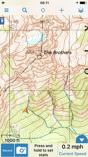 before hitting the first major snowfield. This follows a drainage that is melting out, so we stayed on the scree trail on the left side until crossing over to go climber's right up the snow finger to gain an awkward moss and lichen covered rock shelf.
 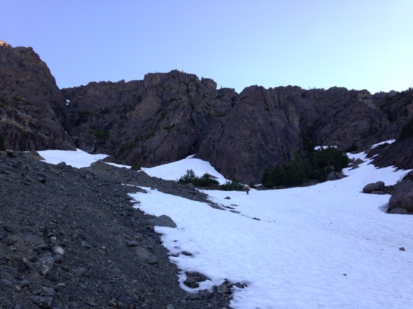 This follows the cliffs to the right, past a small waterfall, and around and up/right to a dry and cairned ridge at 5000'. We walked up the ridge (mostly all dry) following cairns before heading back left into the next higher gully system around 5400'.
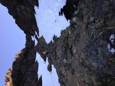
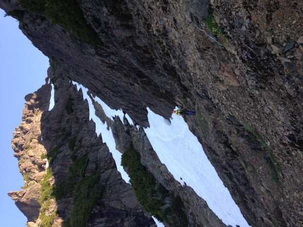 This involved crossing snow, then climbing scree in the middle, then more snow that progressively got steeper as we went up. The "hourglass" I guess is now a steep and narrow snowbridge which will likely melt out soon enough and be quite sketchy. We had relatively firm snow in the morning that allowed for kicking steps, and the gully didn't get sun until we were on our way down around 9 or 10am. At the top of the snow (hugged wall on the left side going up the snow in the photo to reach top of snow):
  is a notch with a large rock which we climbed around to the right, then hit a scree gully- my partner went straight up which seems like the obvious choice, but there is a huge cairn across the gully in front of a slot chimney that is easy enough to scramble up and cairns from there heading up to the right and then hugs the wall to your left as you traverse up and right above scree gullies on your right. Not a ton of fun, but class 2 scree. This leads to a final notch of sorts where you head up and right following the faint trail, and then hugging hard right along the summit block and wrapping back around left is all easy class 2 to get you to the summit proper. Not sure why in other trip reports people talked about 5th class- that's probably possible to do, but explore all your options- there's definitely a non-technical (rope-free) way up. The traverse was almost all snow free, and the summit completely dry. Hard to see much east of the Sound with the morning haze (8:30am), but the Olympics were fantastic. North Brother and Traverse from South Brother summit:
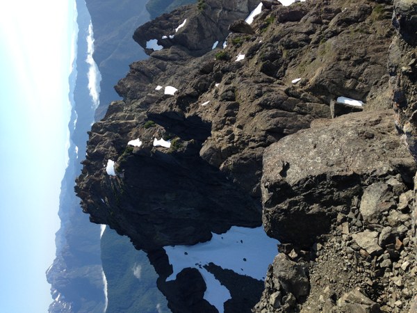
Descended around 8:45am by the same route, and encountered a party of 2 with a dog (?! impressed) and then two other 2-person parties lower down. A long hike out, especially with blisters and knee problems... and with a stop at camp to eat, pack up, tape feet, etc. were back at the car by 4pm.
Strava day 2: https://www.strava.com/activities/1085390031
Party of 2. Gear: ice axe, crampons (one person used for a small section, other didn't), helmet. Note: the idea of bringing more than 4 people up in a group hurts my brain. Not sure why photos are rotated- sorry. Also, glissading in current conditions on any of the snowfields would be suicidal.
 Amanda Silber