Field trip: Conditioning Hiking Series
CHS 1 Hike - Grand Ridge Park: Coal Mine Loop
This trip was originally scheduled for the Pratt River Connector trail but has been moved to Grand Ridge because of weather.
- Tue, Apr 5, 2022
- Seattle Hiking Committee
- Day Hiking
- Adults
- Moderate
- Easy
- Mileage: 6.3 mi
- Elevation Gain: 1,150 ft
- High Point Elevation: 828 ft
- Pace: 1.5 - 2.0 MPH
- 3 (9 capacity)
- Cancellation & Refund Policy
I-90 Exit 22 at 9:30am. Meet along the service road on the south side of the freeway. (This is the road that leads to the main Tiger Mountain trailhead.
This trip was originally scheduled for the Pratt River Connector trail but was changed to Grand Ridge because of weather.
===============
The Pratt River Connector trail is a wonderful little river walk near North Bend that is far more than just a "connector". It is one of the more beautiful nearby trails that satisfies the CHS 1 distance and elevation goals for April.
Because it is beautiful, relatively easy, and not too far from Seattle, it can also be popular on Spring weekends. We'll go midweek and start a bit later in the morning than usual in order to avoid the crowds and morning commute traffic. With a bit of luck we will have the place mostly to ourselves and start our CHS season on a high note.
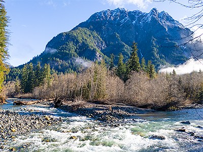
After gathering at the large Middle Fork Trailhead parking lot we'll cross the Middle Fork river itself on the the locally famous wooden rainbow bridge and make a very brief side tour to take in the view of Mount Gardner at the confluence of Taylor and Snoqualmie rivers (see picture above right). Then we'll reverse course and walk almost the full length of the Pratt River Connector trail to a campsite near the intersection with the Pratt River trail. Along the way we'll enjoy peekaboo views of the various mountain peaks that surround Middle Fork Valley. If the weather is nice we'll have lunch on a small hidden rock beach next the water before tracing our route back to the cars.
After the hike, the tentative plan is to stop at Scott's Dairy Freeze in North Bend on the way home for an after-hike snack.
Additional Transportation Information
The Middle Fork Trailhead is located about half hour beyond North Bend, about 15 miles back along the Middle Fork Road. The road and trailhead are fully paved except for about 100 yards of the road, which is unpaved but still easily passable with a standard sedan. There is a privy at the trailhead that is usually in good condition.
Though the trip starts and ends at the trailhead, participants are welcome to arrange carpools .
Grand Ridge Park (Snoqualmie)
-
King County Backcountry Trails - Grand Ridge
see Land Manager - See full route/place details.
Required Equipment
Ten Essential Systems
- Navigation (map & compass)
- Sun protection (sunglasses & sunscreen)
- Insulation (extra clothing)
- Illumination (headlamp/flashlight)
- First-aid supplies
- Fire (waterproof matches/lighter/candle)
- Repair kit and tools
- Nutrition (extra food)
- Hydration (extra water)
- Emergency shelter (tent/plastic tube tent/garbage bag)

