Field trip: Conditioning Hiking Series
CHS 1 Hike - West Fork Teanaway
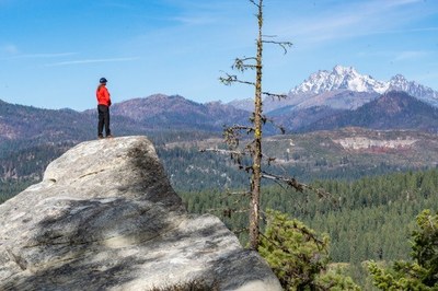
Hike to Cheese Rock and Bible Rock, impressive formations of resistant Roslyn Formation sandstone in the Teanaway Forest. CHS hike led at a CHS 1 pace (1.5-2.0 mph)
- Thu, May 26, 2022
- Seattle Hiking Committee
- Day Hiking
- Adults
- Easy/Moderate
- Moderate
- Mileage: 7.8 mi
- Elevation Gain: 1,275 ft
- High Point Elevation: 2,800 ft
- 3 (9 capacity)
- Wed, Apr 20, 2022 at 9:00 AM
- Tue, May 24, 2022 at 9:00 AM
- Cancellation & Refund Policy
- iCal Google
Cheese Rock and Bible Rock are gigantic sandstones in the Roslyn Formation, formed during the Eocene period when 40 million year-old swamps and rivers existed in this location and a time before the Cascade Range existed. These and other interesting sandstone formations in the Teanaway Community Forest formed when surrounding weaker rocks eroded away. From the top of the sandstone slabs, views of the Stuart Range are possible. Much of this route follows abandoned logging roads. This is a multi-use area and also used by mountain bikes and motor bikes.
9:30am Meet at trailhead. Directions: Start at I-90 exit 85 (Cle Elum). Go east on SR-970 for 6.9 miles. Turn left on Teanaway Road. Go 7.3 miles. Turn left on West Fork Teanaway Road. At 0.6 miles you will pass the entrance to the Teanaway Campground. Continue ~0.5 miles to the end of the pavement and park in gravel parking area. Discovery Pass is required. There is a vault toilet at the TH.
West Fork Teanaway
-
Green Trails Alpine Lakes East (Stuart Range) No. 208SX
Green Trails Mt Stuart No. 209 - See full route/place details.
Required Equipment
Ten Essential Systems
- Navigation (map & compass)
- Sun protection (sunglasses & sunscreen)
- Insulation (extra clothing)
- Illumination (headlamp/flashlight)
- First-aid supplies
- Fire (waterproof matches/lighter/candle)
- Repair kit and tools
- Nutrition (extra food)
- Hydration (extra water)
- Emergency shelter (tent/plastic tube tent/garbage bag)

