Field trip: Conditioning Hiking Series
CHS 2 Hike - Poo Poo Point
CHS hike led at a CHS 2 pace (2.0-3.0 mph) to Poo Poo Point (8.0 miles RT) via the High School Trail. We will stop for lunch at Poo Poo Point - specifically, the North Launch Viewpoint. If the weather is nice we'll be rewarded with views of downtown Seattle and the Olympics. Trail can be very busy. Muddy in spots and one tree is down over trail but easy to get around. Steady gradual climb once we get about 1 mile in.
- Sat, Apr 24, 2021
- Seattle Hiking Committee
- Day Hiking
- Adults
- Moderate
- Moderate
- Mileage: 8.0 mi
- Elevation Gain: 1,850 ft
- Pace: 2.0-3.0 mph
- 1 (7 capacity)
- Cancellation & Refund Policy
-
Gear: You may want to consider wearing boots rather than trail runners as the trail has some muddy areas. No cotton clothing.
Bring some kind of face covering. We will follow Mountaineers protocol by wearing a face covering while within six feet of others.
Food: Bring water and a snack.
Weather:
https://forecast.weather.gov/MapClick.php?lat=47.5301&lon=-122.0344
-
HISTORY
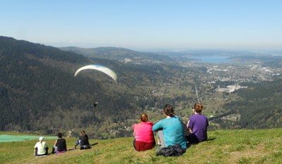
The Poo Poo Point name is a reference to the steam whistle sounds heard throughout the Tigers in the early days of logging. More recently (1970s) the area around Poo Poo Point was logged by its then owners, Weyerhaeuser Corporation. They even took the stumps! The result is a large clear area used now as a launching pad by paragliders who generally backpack their lightweight gear up the Chirico Trail, or sometimes arrive by minibus. The Point also offers a fine view northwest across Issaquah and Lake Sammamish toward Bellevue's downtown. To the west are Squak and Cougar Mountains, with a hint of Seattle's tallest buildings showing beyond.
We will meet at the trailhead at 7:45 am so we can start hiking by 8 a.m.
No parking pass is required. Porta potties are not available.
DRIVING DIRECTIONS
Driving east on I-90, take Exit 18, then merge onto E Sunset Way. Follow it around and turn left (south) onto Second Ave SE. When you are near the high school, look for street-side parking.
To access the High School Trail, park on the shoulder of Second Ave SE near Issaquah High School. Walk south of the high school along Second Ave SE. Cross SE Jones Lane, then turn left onto the Rainier Trail. Follow it a short distance, then turn right at the sign to the High School Trail.
Poo Poo Point via Chirico Trail
-
Green Trails Tiger Mtn No. 204S - See full route/place details.
Required Equipment
Ten Essential Systems
- Navigation (map & compass)
- Sun protection (sunglasses & sunscreen)
- Insulation (extra clothing)
- Illumination (headlamp/flashlight)
- First-aid supplies
- Fire (waterproof matches/lighter/candle)
- Repair kit and tools
- Nutrition (extra food)
- Hydration (extra water)
- Emergency shelter (tent/plastic tube tent/garbage bag)
- Mask
