Field trip: Sea Kayak Navigation
On the Water Navigation - Skagit & Hope Islands
On the Water Sea Kayak Navigation
- Sun, Jun 2, 2019
- Seattle Sea Kayaking
- Sea Kayaking
- Adults
- Sea Kayak II/III
- Moderate
- Mileage: 6.0 nm
- Maximum Wind: 10 kts
- Maximum Waves: 1 ft
- Maximum Currents: 2.6 kts
- 3 (6 capacity)
- 1 (3 capacity)
- Cancellation & Refund Policy
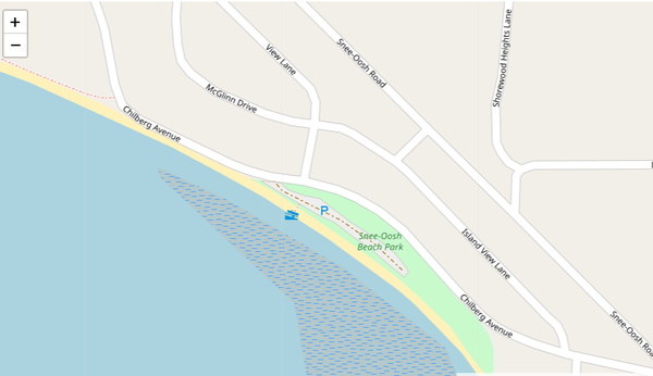
Meet at Snee Oosh Beach Park (48.398543, -122.541208) in La Conner and ready to launch at 9:00 AM
Exercise we will do on this trip:
• Measure your paddling speed.
• Take a bearing
• Calculate the heading based on the known current speed
• Paddle to destination using compass heading only “Dead reckoning”
• Compare the landscape with the map & chart
• Paddling using ranges (transit) – ferrying
• Find course to avoid fast current or using current assist to get to destination
• Observe the current direction and falling or rising tide
• VHF exercise. Please make sure you read "Quick Guide on How to Use VHF", other articles are optional in VHS and VTS folder.
• Check paddling speed at the end of the day (timing)
Please check the Required Equipment tab below.
Required Equipment
Immersion clothing is required. Besides the usual day paddling essentials you must have:
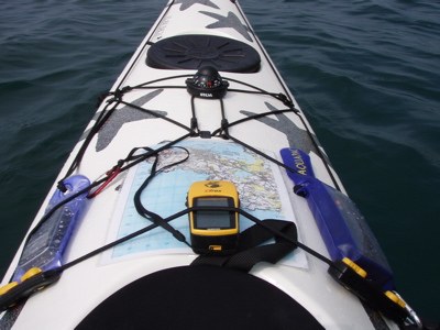
- Marine Compass
- Chart (will be supplied)
- Waterproof watch
- VHF (if this is to fulfill requirement for intermediate badge)
